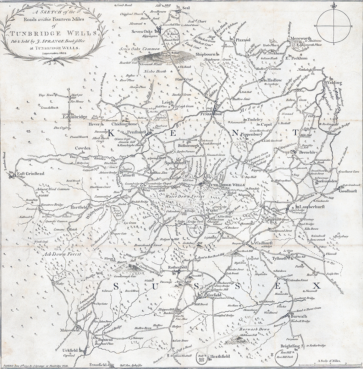
"A Sketch of the Roads within Fourteen Miles of Tunbridge Wells Pub & Sold b J SPRANGE Bookseller at Tunbridge Wells improved to 1802".
A fine example of the scarce map, first published in 1774 and this example, updated & re-published in 1802. The map features Sevenoaks in the north, East Grinstead, Eatonbride, Ashdown Forest in the west, Uckfield and Heathfield in the south and Yalding and Goudhurst in the east. Across the map numerous towns and villages, farms and estates are highlighted including the Calverley House Estate, which was designed by famous Regency architect Decimus Burton (1880-1881). The map also illustrates interesting local topographical features such as River Hill and Milkhouse Toll.
Also included is the original slip case and original paper label. Overall size once opened 44cm x 45cm. Condition is generally fine, laid to linen. Some occasional light tone spots.
£350.00