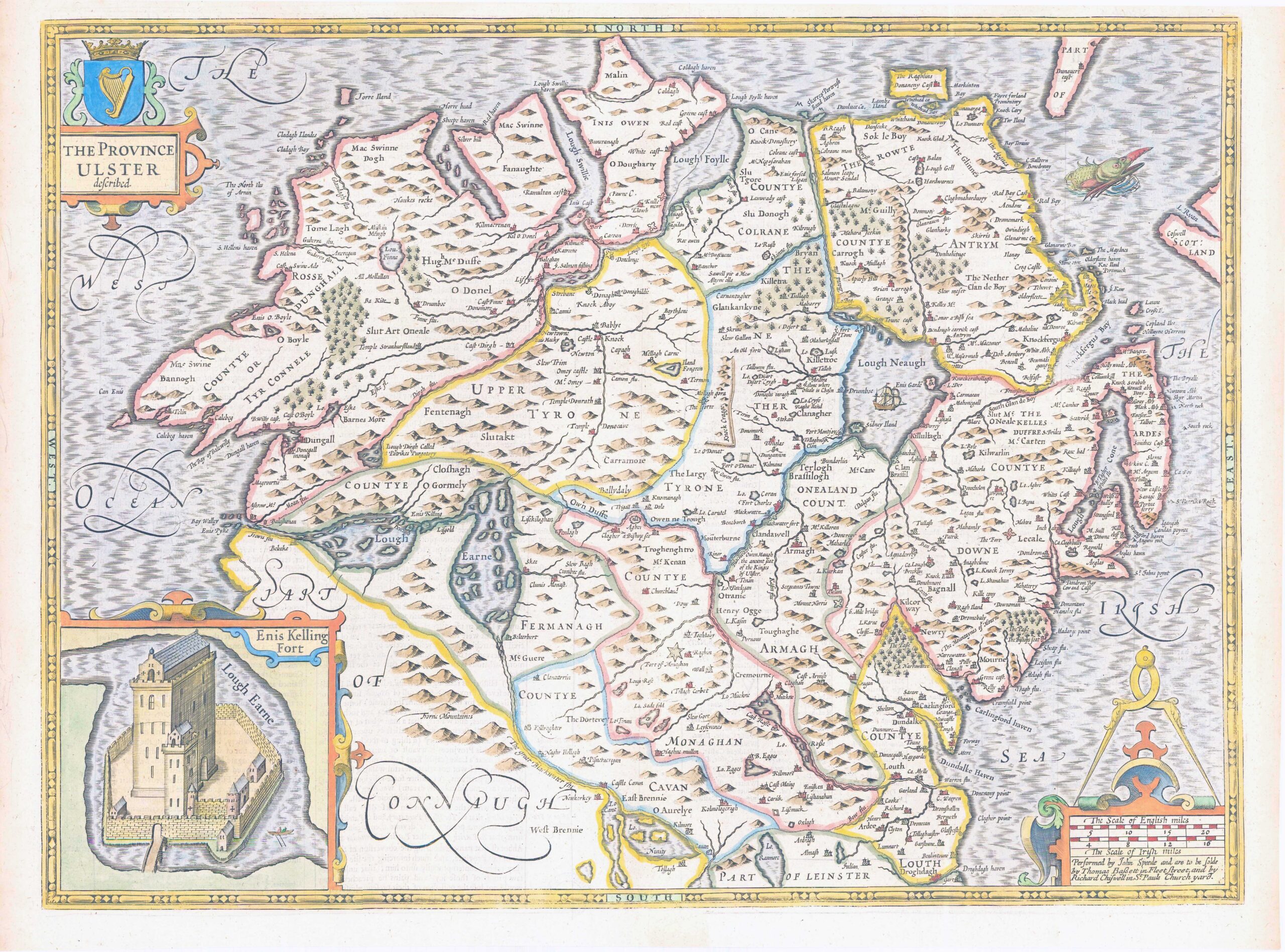
A fine original copperplate engraving of John Speed's decorative map of "THE PROVINCE ULSTER Described". One of four maps of the Irish provinces contained in Speed’s atlas, it contains an inset plan of Enniskillen Fort (shown as “Enis Kelling Fort”) that was based on a drawing by John Thomas of the taking of Enniskillen Castle in 1592. Additional decorations include a sea monster and an Irish armorial. A description of the county appears on the verso in English. Later hand colouring
John Speed (1552-1629) is the most famous of all English cartographers primarily as a result of The Theatre of the Empire of Great Britaine, the first Atlas of the British Isles. The maps from this Atlas are the best known and most sought-after of all county maps. The maps were derived mainly from earlier prototypes fo Christopher Saxon and Robert Norden but with notable improvements include parish "Hundreds" and county boundaries, town plans and embellishments such as the coats of arms of local Earls, Dukes and the Royal Household.
Published in 1676 by Thomas Bassett & Richard Chiswell in Fleet Street, London.
On verso, there is a small Library stamp of approx 2cm circular diameter, which cannot be seen from the front. Verso has also had strengthening archival paper applied to part.,
Overall size including the margins approx 41.5cm x 53cm.
£575.00