1934 -"GUIDE MAP OF GULBARGA FORT"
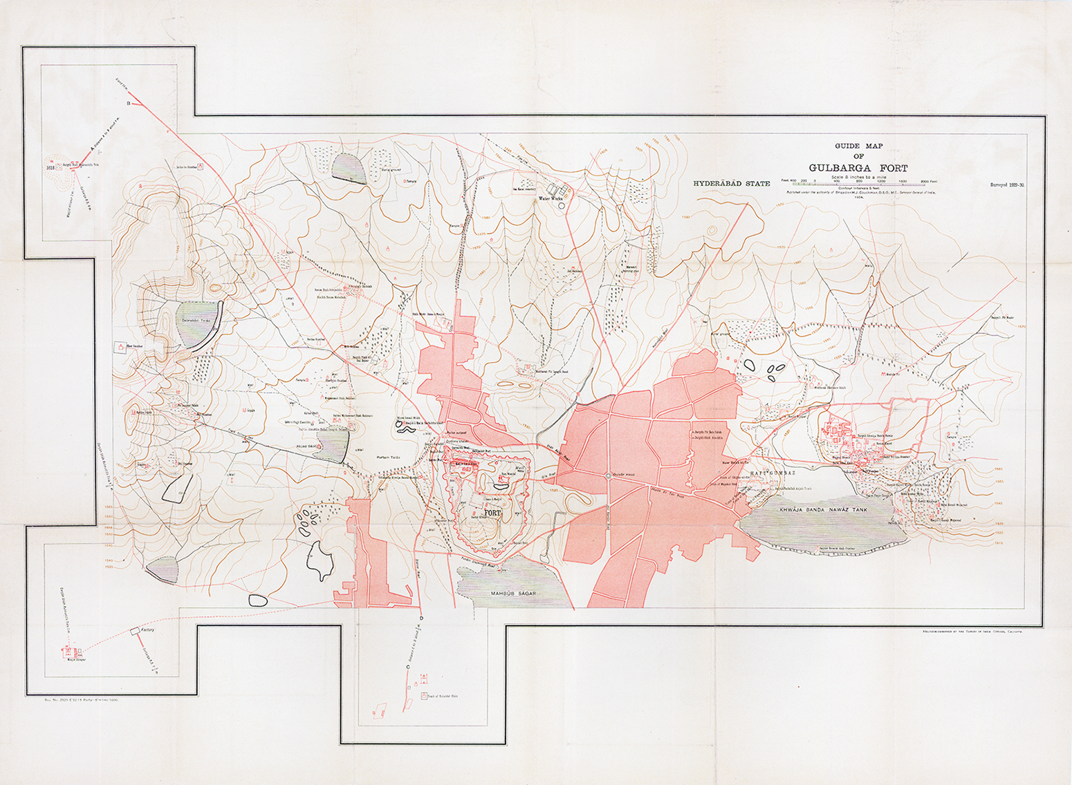
This incredible, large-scale guide map of Gulbarga Fort provides a remarkably detailed overview of the ancient citadel and its surrounding urban landscape within the Princely State of Hyderabad, captured near the twilight of the Nizam’s rule. The primary fortifications were constructed in the 14th century, helping to solidify early Bahmani rule on the Deccan Plateau. While active sieges were scarce after the 17th century, the map still carefully notes surviving ordnance perched atop the walls. Enclosed within the citadel is the historically significant Jama Mosque, complemented by numerous other mosques, shrines, and monumental tombs scattered outside the gates – most notably the Haft Gumbaz to the east. These brilliant examples of early Indo-Islamic architecture are part of a historic complex on the tentative UNESCO World Heritage list for the Deccan Sultanate.
Beyond the monuments, the map excels in its recording of local municipal realities. Contoured topography and the private holdings of individual 1930s landowners are mapped alongside an extensive survey of the region’s vital water infrastructure. Notoriously arid during the summer months, the landscape is heavily dotted with precisely plotted wells, stepwells (baolis), retention ponds, and cisterns designed to capture the vital monsoon rains. The prominent reservoirs and associated waterworks played a critical role in delivering irrigation and drinking water to the old city’s residents.
The map was published in 1934 under the authority of Brigadier H.J. Couchman, the Surveyor General of India. It was expertly heliozincographed (an early photo-lithographic printing process using zinc plates) at the Survey of India offices in Calcutta.
Overall size 30 x 20in approx. Excellent condition. Folding Map linen backed.
£110.00