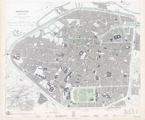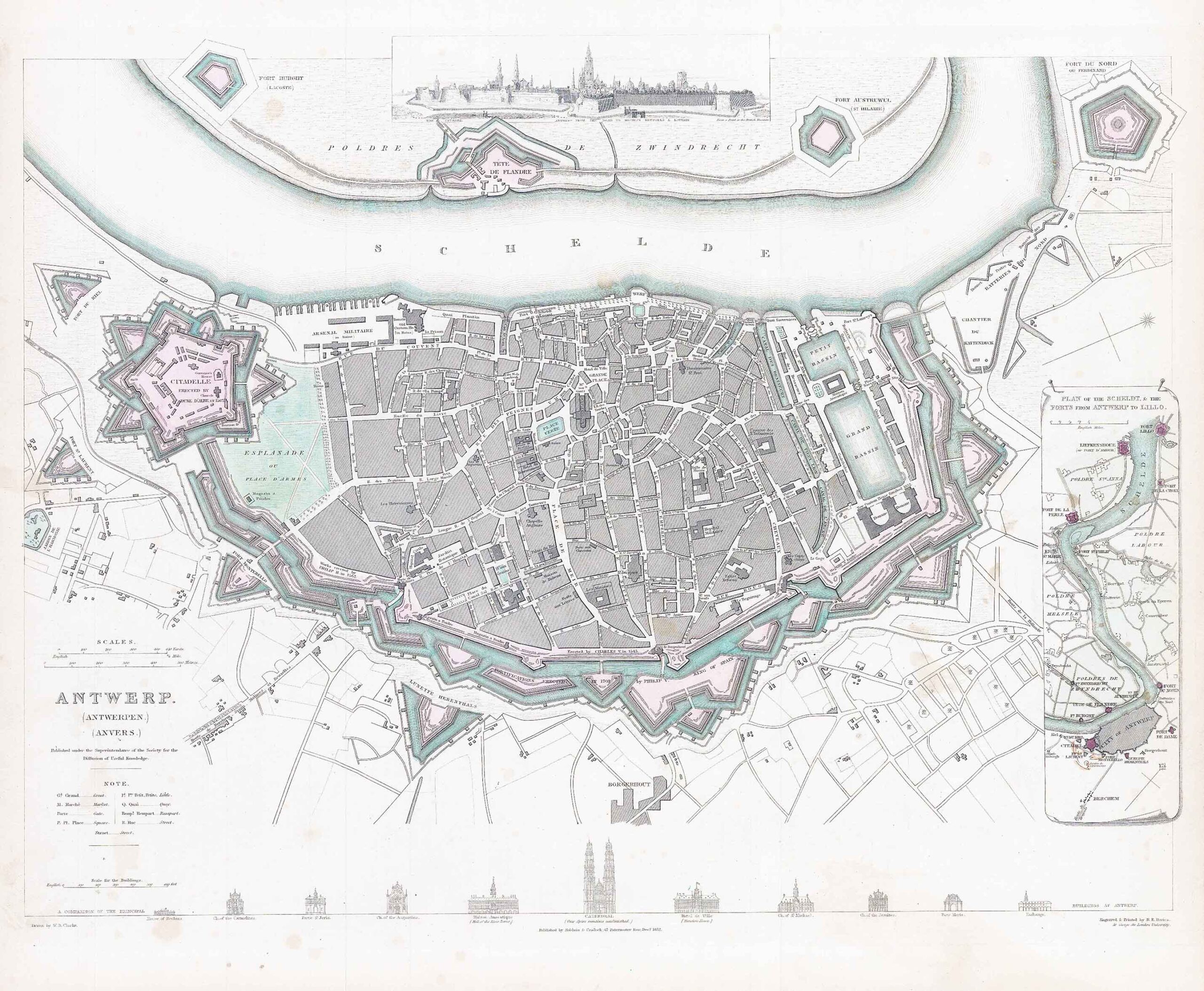
1832 - Detailed town plan, with elevations of the most important buildings under the map. Above the map is a prospect of the town 'From a print in the British Museum'. On the right side of the map is a 'Plan of the Scheldt, & the Forts from Antwerp to Lillo.
Size approximately 40.5cm x 34.5cm including margins.
Condition is excellent with original hand colour.
£75.00