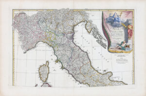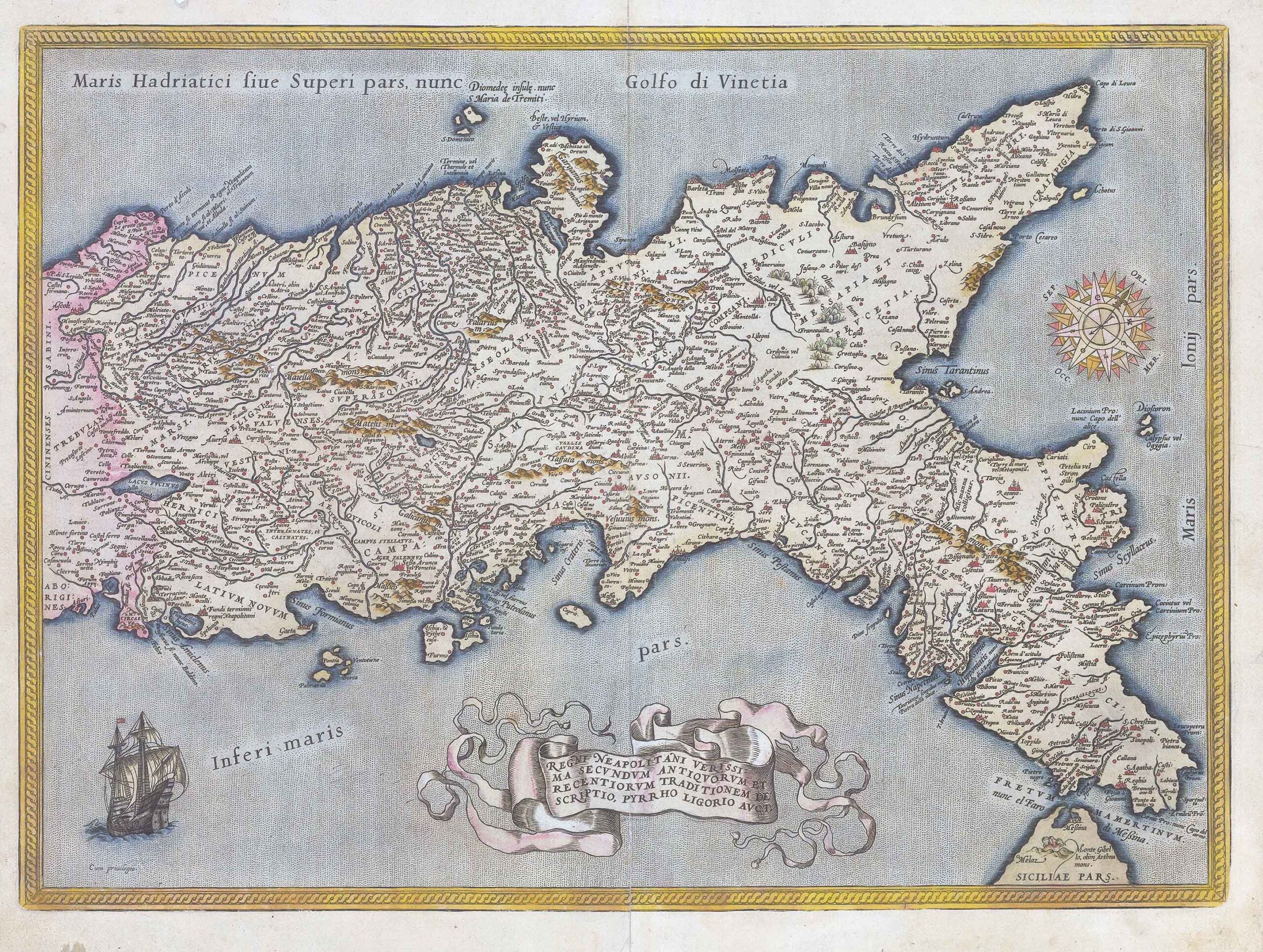
1584 - "Regni Neapolitani Verissima Secundum Antiquorum et Recentiorum Traditionem Descriptio, Pyrrho Ligorio Acut"
A fine old colour example of Abraham Ortelius's map of Southern Italy. Oriented to the east, this map covers central Italy to northern Sicily and from the Adriatic Sea to the Tyrrhenian Sea. The map identifies countless cities and towns as well as major rivers with topography and forests rendered in profile. A sailing ship decorates the bottom left corner and an elaborate compass rose appears on the upper right area. This map is based on Pirro Ligorio's map of the region.
Overall size approximately 52cm x 39.5cm including margins.
Condition generally very fine with central fold as issued.
Latin text on verso.
£715.00