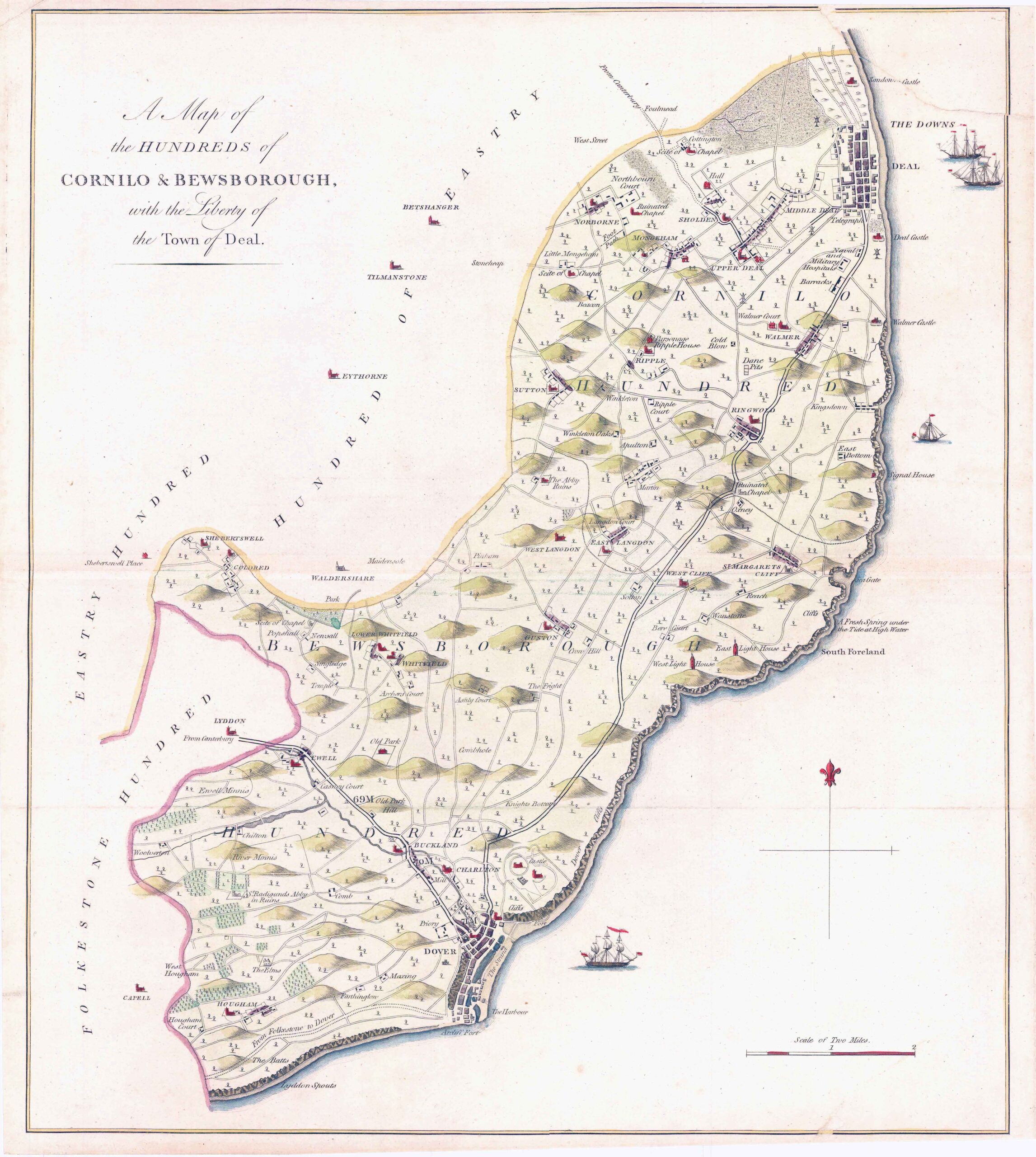
1778 Original Antique engraved Map titled: 'A Map of the HUNDREDS of CORNILO & BEWSBOROUGH with the Liberty of the Town of Deal' And showing the areas of Deal, Sholden, Norborne, Upper Deal, Walmer, Ripple, Ringwold, Sutton, St Margarets Cliff, West Cliff, Langdon, Whitfield, Ewell, Hougham, Dover, Charlton, Buckland, Guston etc.
A fine rare original copper engraving measuring 390mm x 450mm with good to large margins, perfect for mounting and framing.
Taken from Hasted's 'History of Kent'.
CONDITION: Original antique print is in excellent condition with the central folds as issued and with expert hand colouring. There is some sign of age, being nearly 250 years old but once mounted and framed, will look superb.
£129.80