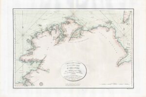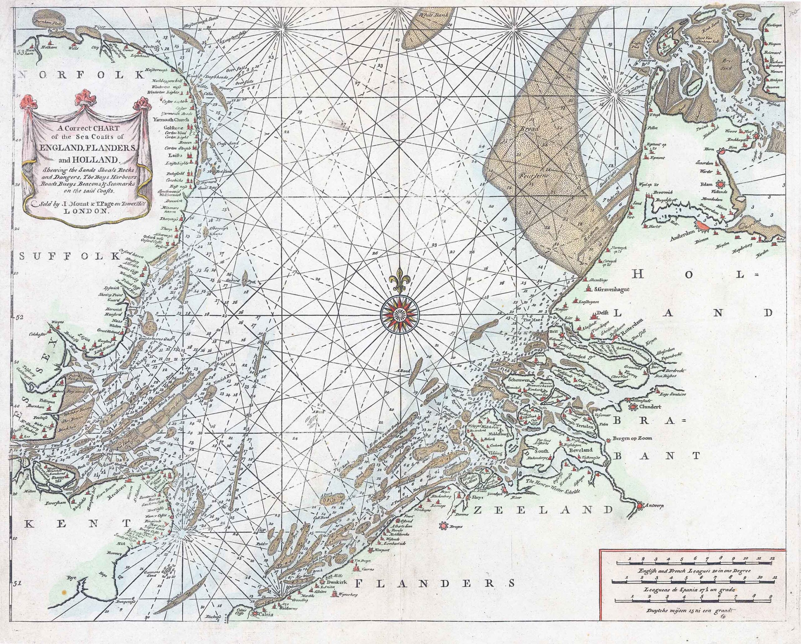
"A Correct CHART of the SEA COASTS of ENGLAND, FLANDERS and HOLLAND shewing the Sands Shoals Rocks and Dangers, The Bays Harbours Roads Buoys Beacons & Seamarks on the said Coasts - Sold by I Mount & T Page on Tower Hill LONDON" - Nice example of Mount & Page's map of the Channel and contiguous British, Belgian and Dutch Coastlines.
The imprint of "W.& J.Mount & T.Page" helps date this particular example to c.1750. The chart had first been published 1671-1672 by John Darby in John Seller's "The English Pilot". The chart extends northwards along the English coast from Rye in Kent to Holkham in Norfolk, and from Calais in France to Amsterdam, Edam and Harlingem in The Netherlands. A compass rose appears centrally on the chart and the mileage scale appears in the lower right corner.
Overall size approx 56cm x 45cm including margins.
Condition is very fine with central fold as issued & later hand colour.
£240.00