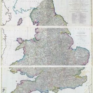
c1902 - " RAILWAY MAP OF ENGLAND & WALES Revised by the various companies Also showing Canals "
A magnificent very large folding map with Railway routes shown in colour. The map, on a scale of eight miles to the inch, shows every passenger station, while enlarged insets show London, environs of London, environs of Liverpool and Manchester, environs of Newcastle, environs of Leeds and Bradford, environs of Birmingham and Wolverhampton, environs of Sheffield and Nottingham, environs of Swansea, District of Cardiff and Merthyr. Bound in original red pebbled cloth with lettering stamped in gilt.
Approx size 112cm x 130cm once folded out.
In excellent condition.
£165.00