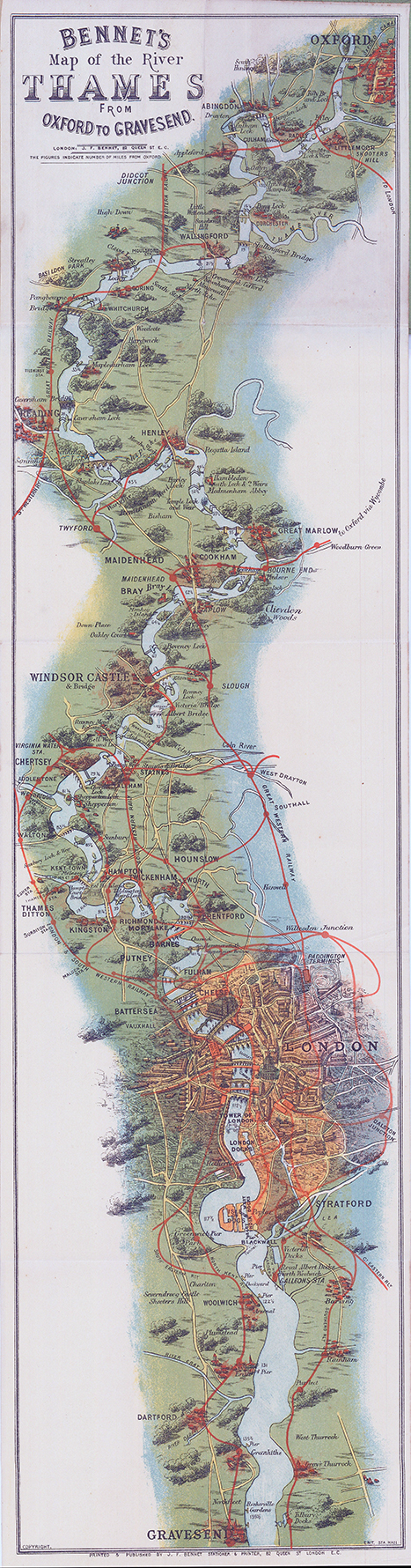
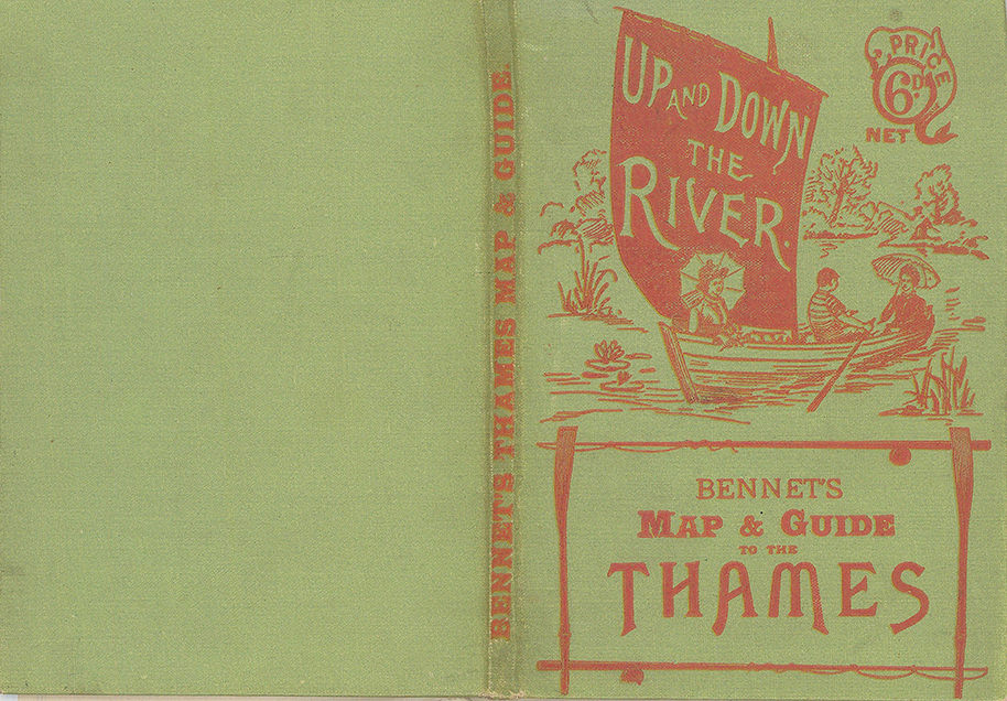
London : J. F. Bennet, c1900. A popular and attractive map of the best-known stretch of Thames, produced by the City of London printer and stationer, John Frederick Bennet of Queen Street, manufacturer of “Wryte-eezy” stationery, and whose shop is illustrated among the numerous and entertaining advertisements. The map is accompanied by twenty pages of text, with notes on angling, boating, steam-launches, locks and tolls, with a distance-table, and an A-Z guide to the riverside towns and villages. First published in 1889.
Coloured lithograph on thin card, folding into a pictorial cloth case. Printed surface 744 x 185mm (approx. 29-1/4” x 7-1/4”)