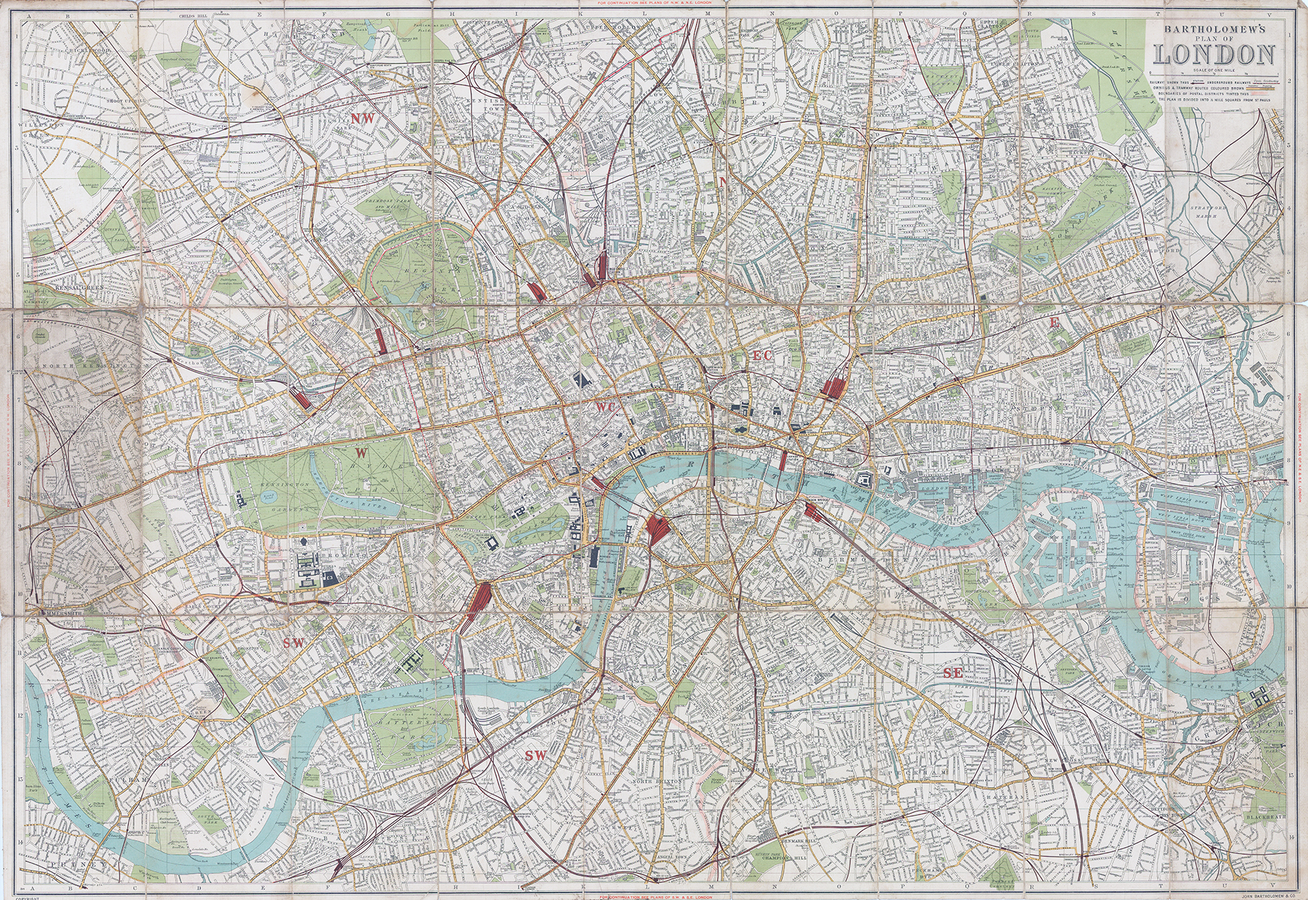
C1900 "BARTHOLOMEW'S PLAN OF LONEON - SCALE OF ONE MILE".
A large folding map dissected into 27 sections and laid to linen. A highly detailed map streatching, in the north, from CRICKLEWOOD across to LOWER CLACTON and in the south, from FULHAM through BRIXTON and across to BLACKHEATH. Highlighting Railway Stations & lines, Omnibus & Tramways Routes and Postal District Boundaries highlighted in Pink. Published by John Bartholomew & Co.
Overall size approx 83cm x 56cm. Condition is presentable with most of the folding corners slightly worn and some linen splits which have been restored.
£100.00