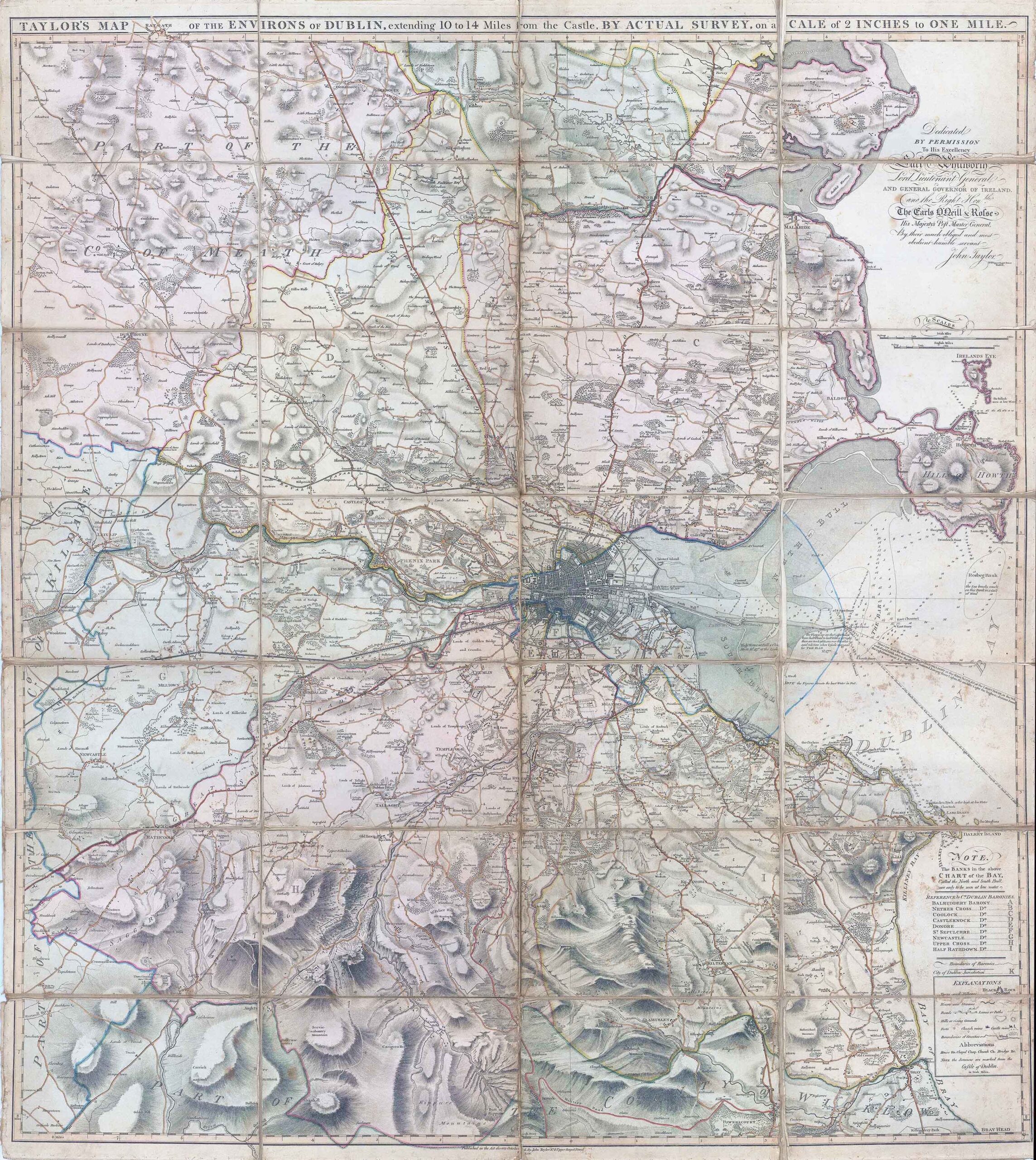
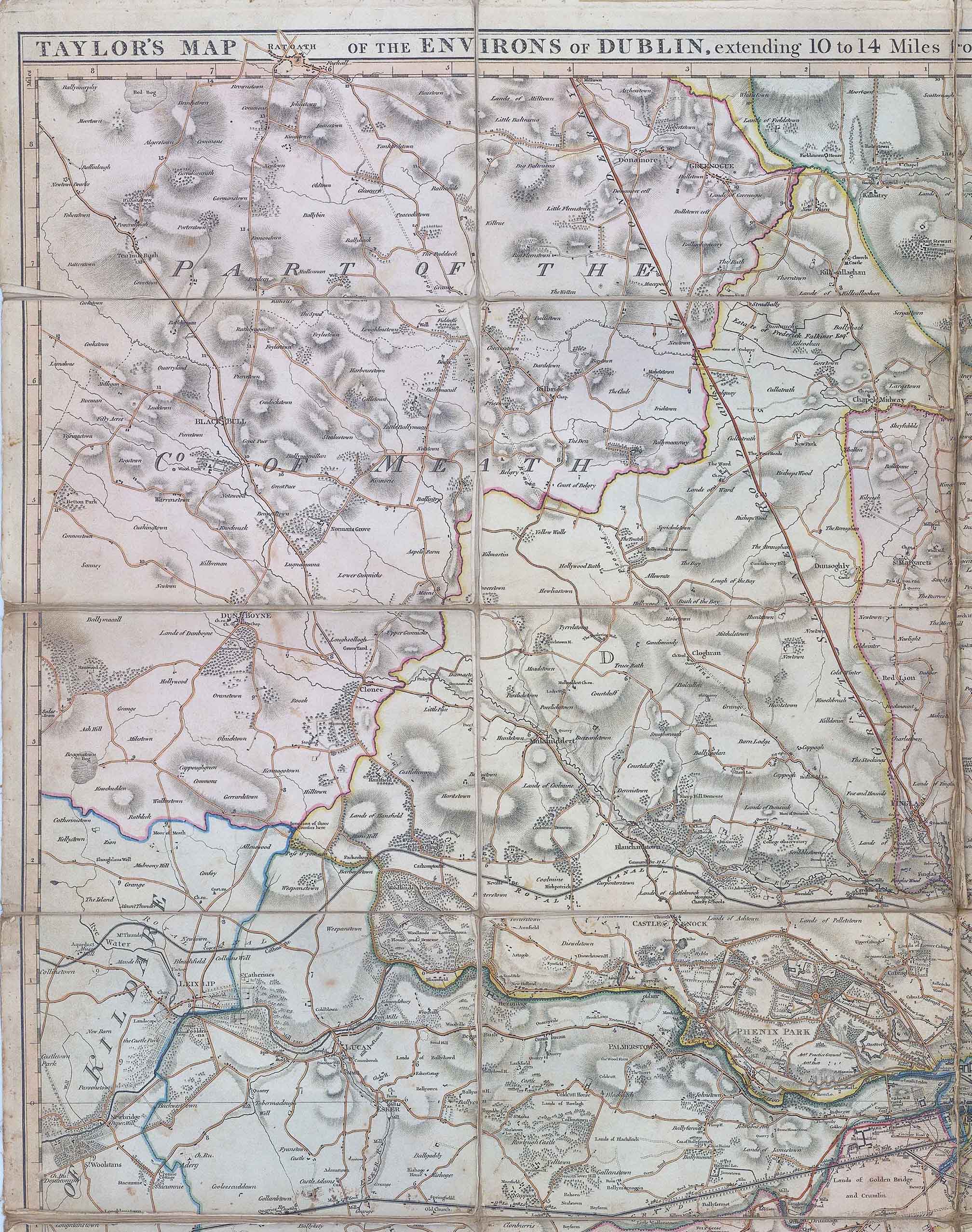
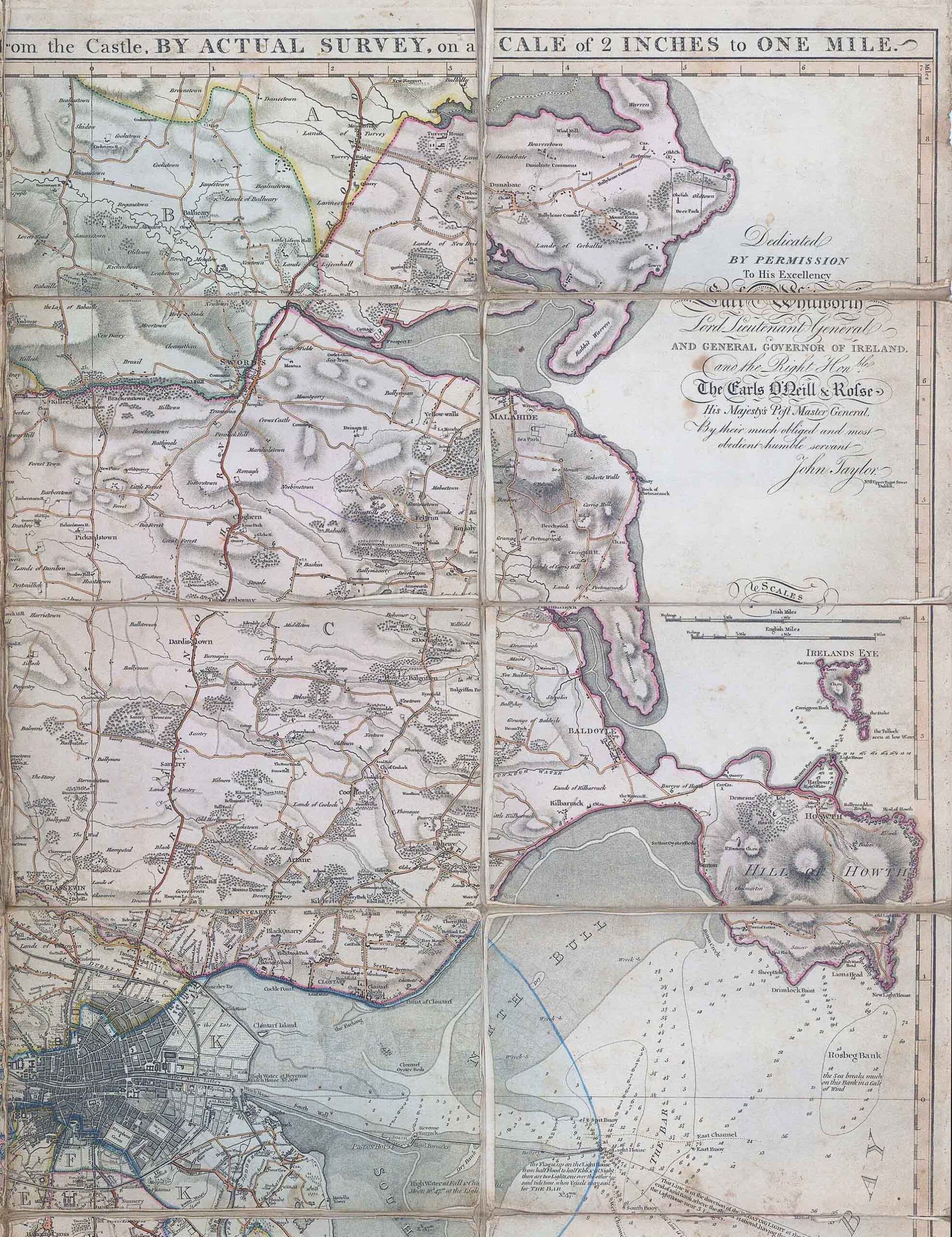
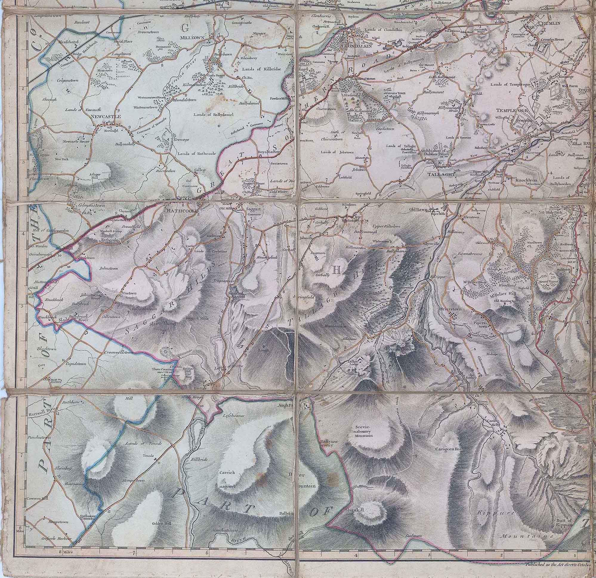
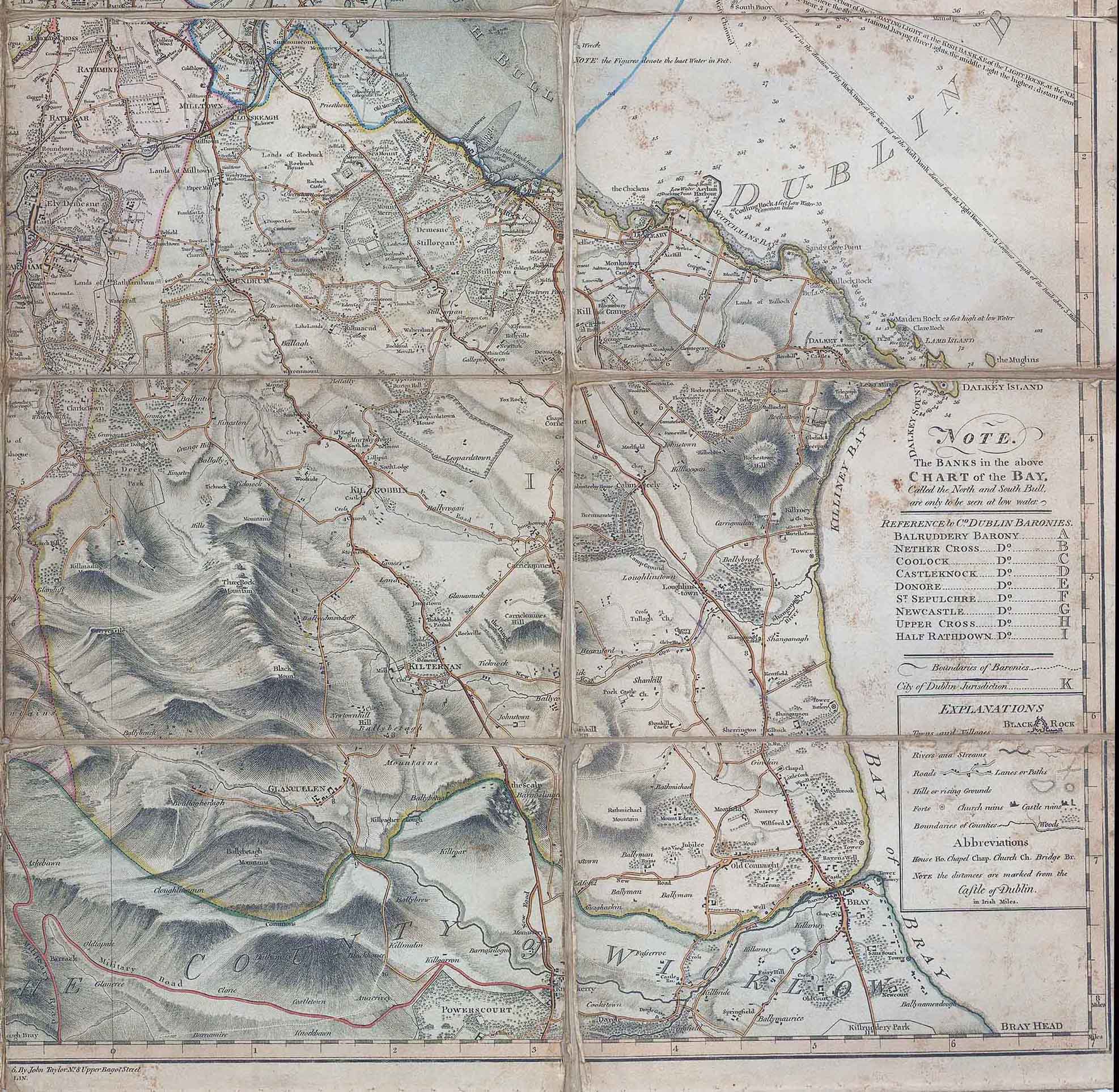
1816 - "TAYLOR'S MAP OF THE ENVIRONS OF DUBLIN extending 10 to 14 Miles from the Castle BY ACTUAL SURVEY on a SCALE of 2 INCHES to ONE MILE - Dedicated by permission to the excellency Earl Whitworth Lord Lieutenant General and General Governor of Ireland. and the right honble. the Earls O'Neill & Rolse his majesty's post master General, by their much obliged and most obedient humble servant John Taylor - No 81 Bagot Street Dublin".
A magnificent and very large scale map dissected into 28 sections and laid to linen.
Overall size when opened 90cm x 80cm.
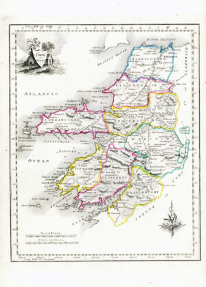
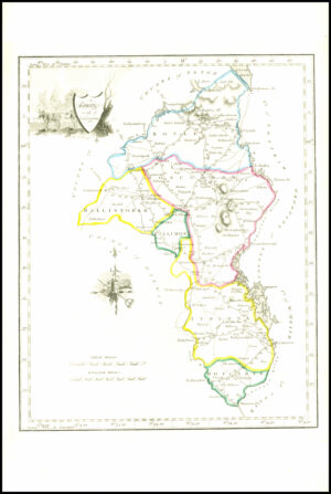
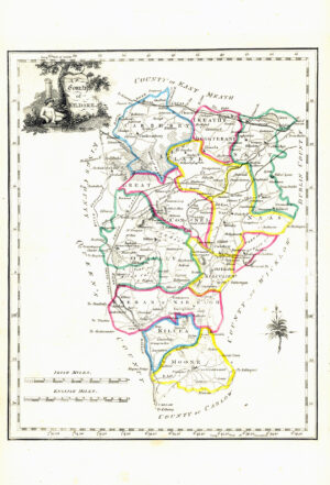
Condition is generally ok with some ageing and tone spots on the right hand side. Most of the folds show signs of wear but with some attention could be restored to exhibition quality. A highly detailed map of County Dublin with place names and baronies indicated. Dublin shown in plan form & Includes soundings for Dublin bay.
John McKinley Taylor (fl. 1765-1819) , active 1790-1825 cartographer, publisher in Dublin. Taylor was descended from David McKinley, a captain in the Inniskilling Dragoons, who fought at the battle of the Boyne. He entered the Dublin Society's Schools in 1765, and was afterwards extensively employed as a seal-engraver; most of the official, episcopal and corporation seals in Ireland at the end of the eighteenth century being his work. He also engraved maps for the Dublin Society, including the map of the Botanic Gardens in the "Transactions" for 1800, and various other maps and plates in the series of "Statistical Surveys" of the Irish counties. He married a descendant of Patrick Sarsfield, and on inheriting the property of his maternal grandfater assumed the name of Taylor. No mention of him has been found after 1819. He was the father of the painter and writer on Art, W B S Taylor. (This information was published in 'A Dictionary of Irish Artists' in 1913).
£1,000.00