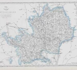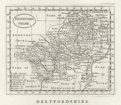
c1780 – “HERTFORDSHIRE”
Published in London, circa 1780. An attractive copper engraved antique county map published in circa 1780 for Francis Grose's "The Antiquities of England & Wales". The map with plain title cartouche and separate scale of distance. Interesting topographical and historical text appears beneath the map and is continued on the verso.
Image size of print approximately 330mm x 220mm, perfect for mounting and framing.
John Seller (circa 1630-1697) was a cartographer and scientific instrument maker who sold his work from his shop at 'The Mariner's Compass' in Wapping, London. This was an area much frequented by sailors who disembarked at Wapping and who often had information useful to Seller for his nautical charts. Seller also offered instruction in "Arithmetick, geometry, algebra, trigonometry, navigation and gunnery; likewise the use of globes and other mathematical instruments, the projection of the sphere and other parts of the mathematics."
Seller was a non-conformist and was found guilty of conspiring to kill King Charles II. He was, however, let off and curiously, was appointed Hydrographer to Charles II in 1671. In the same year he published the first volume of an intended maritime atlas entitled 'The English Pilot'. In 1672 he published volume 2 and parts of volumes 3 and 4 but eventually he abandoned the project and in 1680 sold the rights of publication.
Following this, in 1693 he began work in conjunction with others on a survey of England and Wales which was to be called the 'Atlas Anglicanus' but this project also came to an end after only six maps had been completed.
Next came the 'Anglia Contracta', a small atlas of the counties of England and Wales. Based on the work of John Speed they ere a good deal simpler with plain titles and scales. Although they may appear crude they are nevertheless attractive in their simplicity. The maps were accompanied by text. Editions were issued in 1696, 1697 and 1703 and the maps were used to illustrate Camden's 'Britannia Abridged' in 1701. They were also incorporated into 'The Antiquities of England and Wales' by Francis Grose between 1773 and 1787.
£22.00