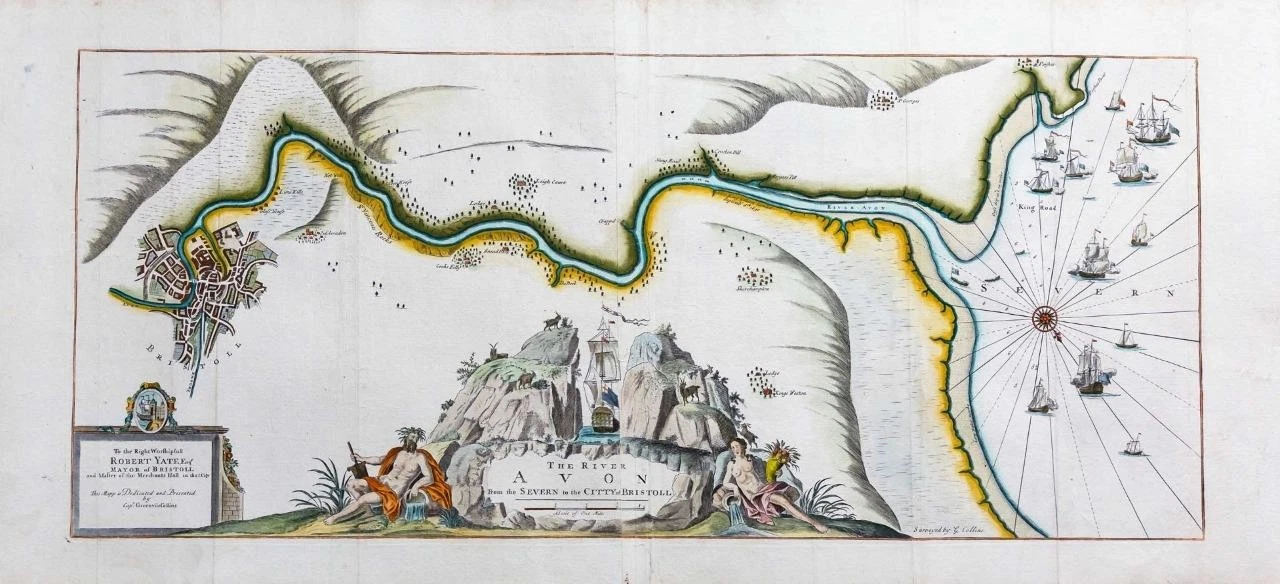
c1693 Very Large original copper engraved antique map on two conjoined sheets titled: "THE RIVER AVON from the SEVERN to the CITTY OF BRISTOLL - To the Right Worsipfull Robet Yate Esq Mayor of Bristol and Master of the Merchants in that City - This Mapp dedicated and presented by Capt Greenvile Collins"
This navigation chart, which is oriented towards the south, shows the courrse of the River Avon from the City of Bristol, a plan of which is shown in some detail, to the Severn estuary. Places marked include Porshuit (Portishead), Pill, Shirehampton, King's Weston, Clifton, Hotwells and the place where King William III landed on this return from Ireland during the Williamite War in 1690. The title cartouche depicts a sailing vessel passing through the Avon Gorge.
This map was created by the maritime Cartographer, Captain Greenvile Collins. Collins was an officer of the Royal Navy and prominent hydrographer who was commissioned by King Charles II in 1676 and appointed by Samuel Pepys (then secretary to the Admiralty) to chart the Coasts of Great Britain and the result was his 'Great Britains Coasting Pilot'.
Condition: This map is in excellent condition with later hand colouring. Overall size approx 106cm x 50cm.
£600.00