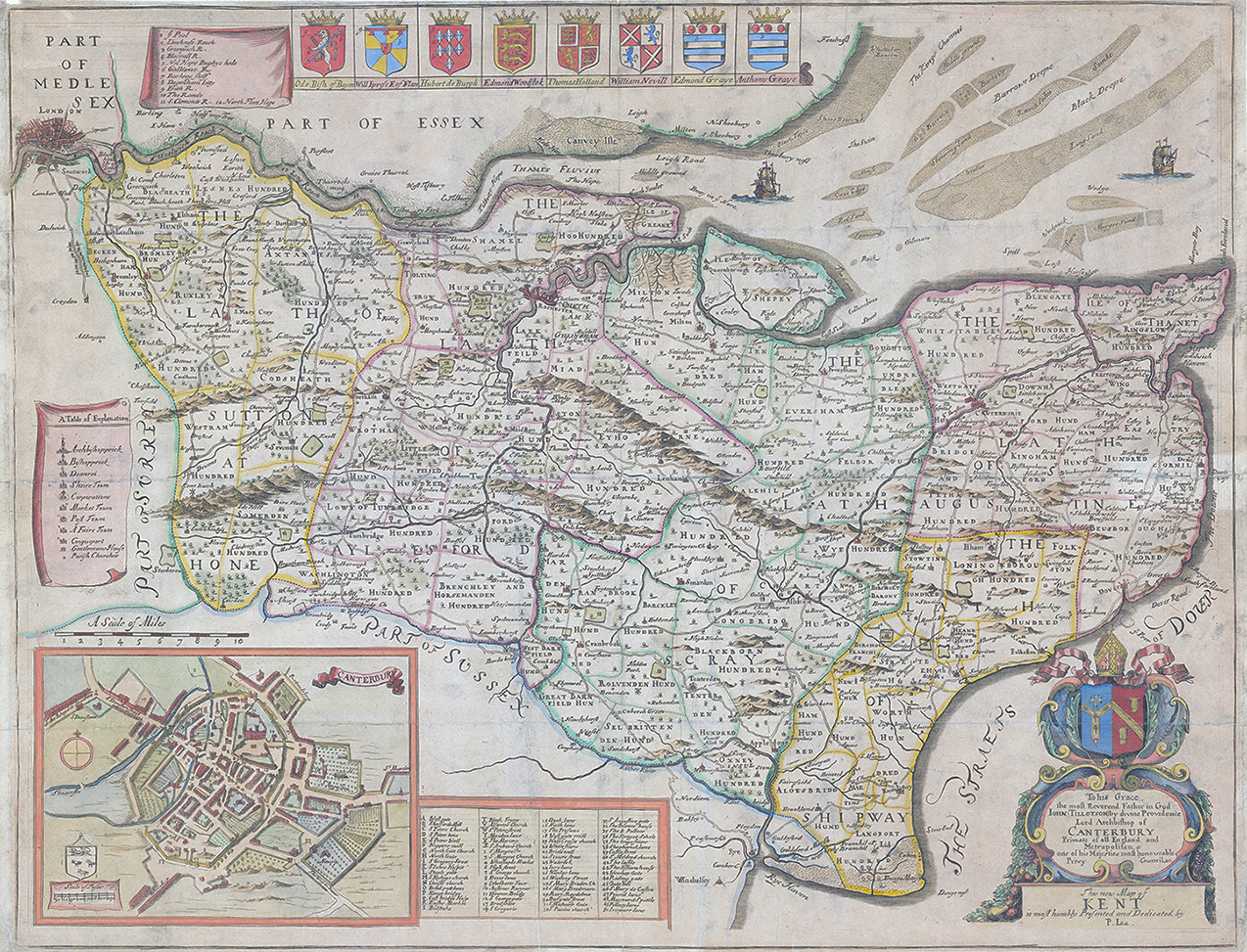
"THIS NEW MAP OF KENT IS MOST HUMBLY PRESENTED AND DEDICATED BY P.LEA".
A fine example of the scarce map by Philip Lea. "To his Grace the most Reverend Father in God John Tillotson by divine Providence Lord Archbishop of CANTERBURY Primate of all England and Metrapolitan & one of his Majesties most honourable Privy Council & c". Inset plan of Canterbury with table of the streets and buildings, decorative cartouche in the bottom right, coats of arms of the important Kentish families. A Table of Explnation of the signs within the map and in the top left, a plan of London.
Overall size approx 54,5cm x 42cm including margins. Condition is presentable with several folds as issued. Overall the map is slightly toned and there is one historical repair to verso in the right margin.
Philip Lea (fl. 1683-1700) was a central figure in the London map community at the end of the eighteenth century. He apprenticed under Robert Morden, with whom he later collaborated. Lea was made free of the Weavers Company in 1689. He was a publisher and a globe and instrument seller with ties to members of government. For example, Samuel Pepys lists him as his map advisor and colorist. He was not known primarily for his own original works, but for his reworking and reissuing of the work of others, particularly the county maps and world map of Christopher Saxton. He also acquired plates from John Seller, John Ogilby, and William Morgan, among others. Later in his career, he collaborated frequently with Herman Moll. After his death in 1700, Philip’s wife, Anne, carried on the business for several decades
£750.00