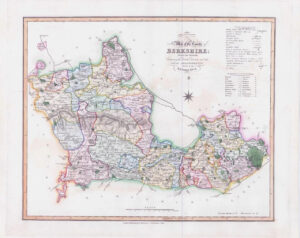
c1650 - A large original antique print map titled: " HANTONIAE COMITATUS CUM BERCHERIA "
CONDITION: Overall good condition with lovely hand colouring and central fold as issued. The top and the bottom of the central fold has split at some time and has had some re-enforcement added on the reverse. As expected for a map of 370 years old, there is some very light mild age toning, but once mounted and framed, will look fantastic. Latin text on the reverse.
Overall size 55cm x 44cm.
A highly decorative copper engraved 17th Century Map of HAMPSHIRE (Latin Edition) including some areas in the bordering county in Berkshire, which was published in Jan Jansson's atlas of the world "NIEUWEN ATLAS", volume 4 containing the English County Maps, first published in 1646. The unusual western orientation of the counites creates a different perspective of the counties.
This example shows the 7 coats of arms of the local Gentry with decorative cartouches top and bottom right. Compass Rose in the English Channel and showing the border with the Isle of Wight. Latin text on the reverse.
Johannes Janssonius was born in Arnhem, (1588 - 1664) the son of Jan Janszoon the Elder, a publisher and bookseller. In 1612 he married Elisabeth de Hondt, the daughter of Jodocus Hondius. He produced his first maps in 1616 of France and Italy. In 1623 Janssonius owned a bookstore in Frankfurt am Main, later also in Danzig, Stockholm, Copenhagen, Berlin, Königsberg, Geneva and Lyon. Elisabeth Hondius died in 1627 and he remarried Elisabeth Carlier in 1629. In the 1630s he formed a partnership with his brother in law Henricus Hondius, and together they published atlases as Mercator/Hondius/Janssonius.
Under the leadership of Janssonius the Hondius Atlas was steadily enlarged. Renamed Atlas Novus, it had three volumes in 1638, one fully dedicated to Italy. In 1646, a fourth volume came out with "English County Maps", a year after a similar issue by Joan Blaeu. Janssonius' maps are similar to those of Blaeu, and he is often accuséd of copying from his rival, but many of his maps predate those of Blaeu and/or covered different regions. By 1660, at which point the atlas bore the appropriate name "Atlas Major", there were 11 volumes, containing the work of about a hundred credited authors and engravers. It included a description of "most of the cities of the world" (Townatlas), of the waterworld (Atlas Maritimus in 33 maps), and of the Ancient World (60 maps). The eleventh volume was the Atlas of the Heavens by Andreas Cellarius. Editions were printed in Dutch, Latin, French, and a few times in German.
After Janssonius's death, the publishing company was continued by his son-in law, Johannes van Waesbergen. The London bookseller Moses Pitt attempted publication of the Atlas Major in English, but ran out of resources after the fourth volume in 1683.
£485.00