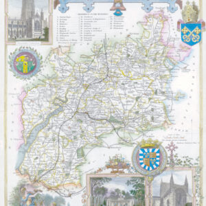
c1650 "GLOCESTRIA DUCATUS cum MONUMETHENSI Comitatu GLOUCESTER SHIRE & MONTMOUTHSHIRE".
A fine original antique map of Gloucestershire & Monmouthshire from Jansson’s atlas of the world “Novus Atlas”, Volume IV containing the English county maps, first published in 1646. The map contains the usual Jansson decorations; including coats of arms of the noble families of the counties and a scenes of local life adorned with putti. A description of the counties appears on the verso in French.
The map has a professionally repaired centrefold split, a repaired tear at the bottom left corner and has some mild toning to the upper area.
Overall size approximately 52cm x 43xcm.
£330.00