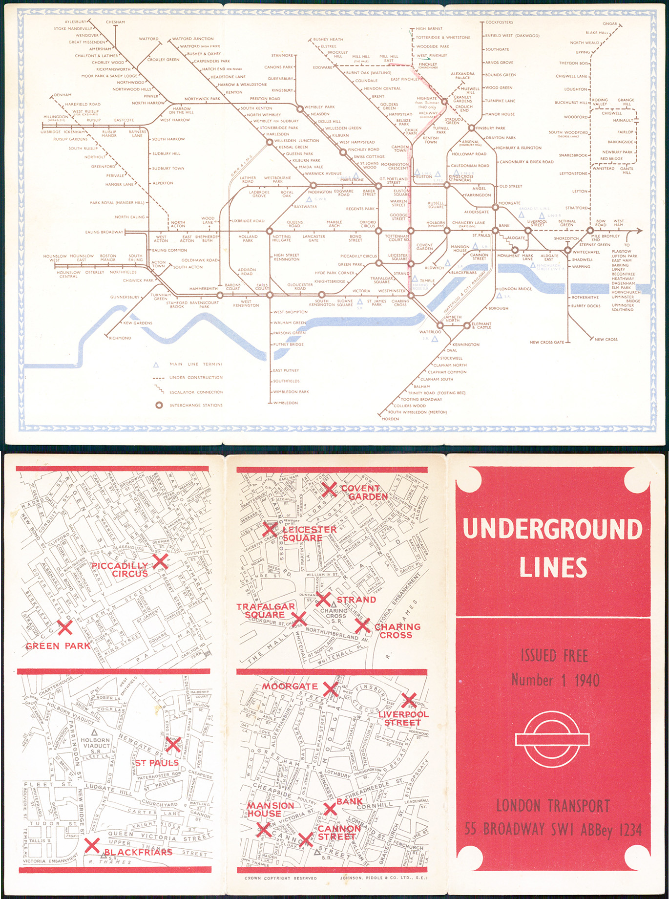


1940 A fine exampe of this rare original vintage London Underground Map designed by Hans Schleger. Overall size approx 23cm x 15.5cm. Condition is generally good with some minor signs of wear.
This edition of the Underground map is by Hans Schleger (who went under the pseudoynm of "Zero"). The lines are all shown in the same brown colour with a light blue border. This map does not have the blue airbrush background from the 1939 edition. Mainline stations are indicated by a light blue triangle, and the Bakerloo line extension to Stanmore is open. On the reverse of the map are four maps of Central London with the Underground Stations marked by a cross. Highgate Station is noted as 'from summer 1940 only'. The map continues to show as under construction the "New Works Plan" (Northern Heights project) to take over the ex-GNR line between Finsbury Park and Edgware and High Barnet, including the Alexandra Palace branch. These were to be incorporated into the Northern Line with a new connection with the Northern City line at Finsbury Park, and an extension from Edgware to Bushey Heath. The project was abandoned at the onset of World War 2 and never restarted, though these lines continued to be shown as under construction until 1950. The Central Line extension to the west is shown as being under construction as far as Denham (though it eventually was only completed as far as West Ruislip), and to Ongar in the east. The map includes the "Middle Circle", an underground train line using the West London Railway between Latimer Road and Earls Court, passing through Uxbridge Road and Addison Road. The line closed in 1940 following bomb damage. It was not reopened until 2008 as part of the Overground network.
£180.00