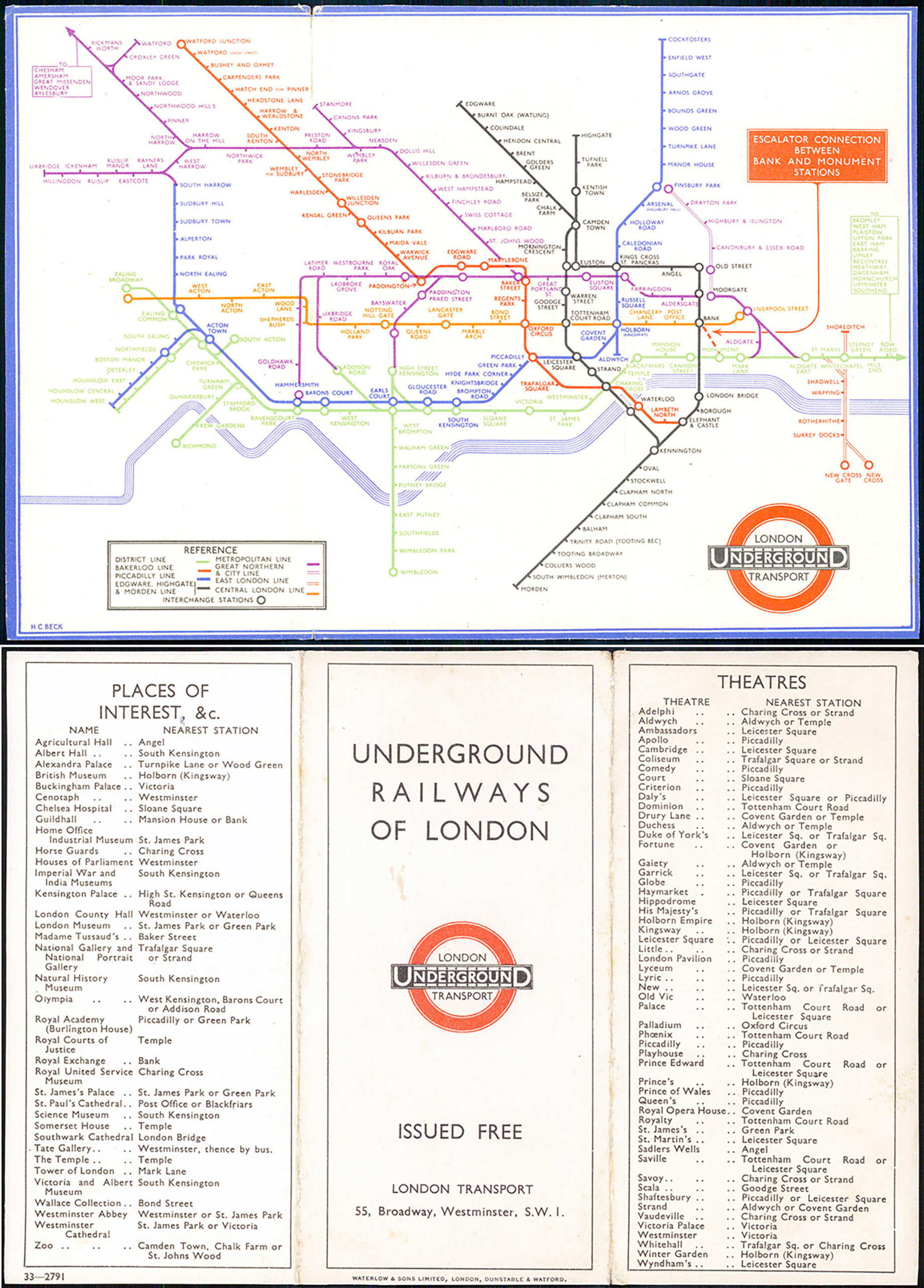
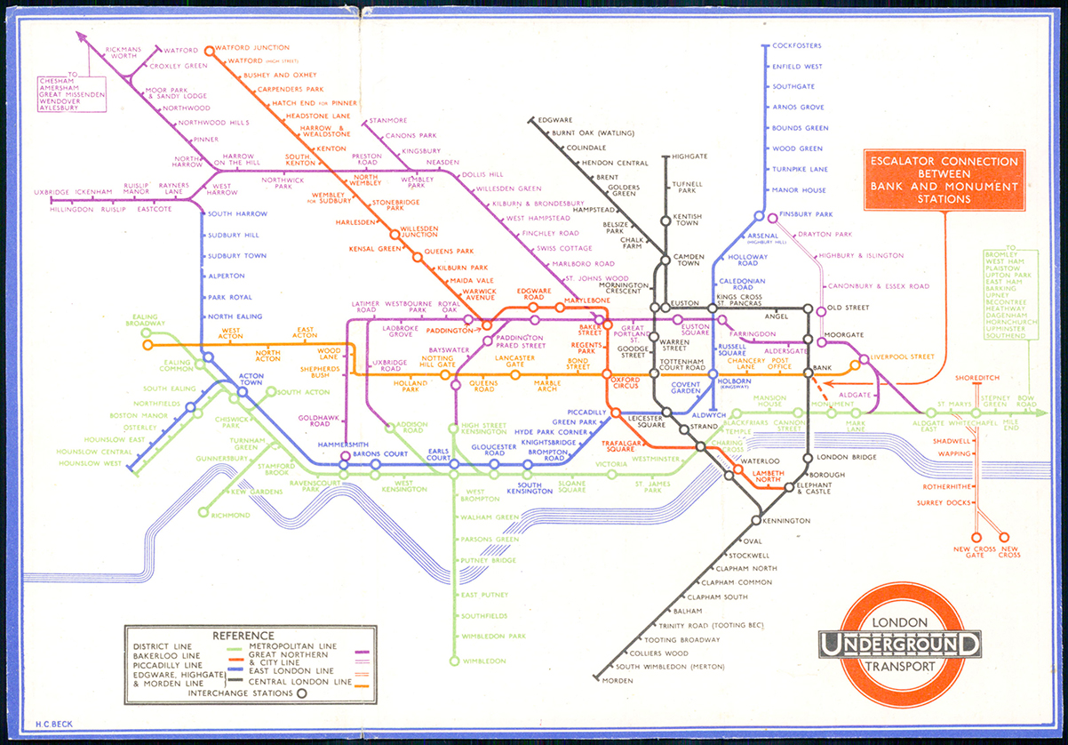
1933 A fine example of this very rare 1st year edition of the folding London Underground Map with the iconic design by Harry Beck.
This example is the third folder edition issued in September 1933 (33-2791). Similar to the second edition except for (a) the smoothing out of a kink to the District Line between Ealing Common and Easling Broadway, left over when the out-ward stretch from Ealing Broadway was handed over to the Piccadilly Line; (b) the substitution of "LONDON TRANSPORT" for "L.P.T.B." within the bullseye; and (c) the inclusion of the new escalator connection between Bank and Monument stations, accompanied by the prominent notice to this effect on the top right corner.
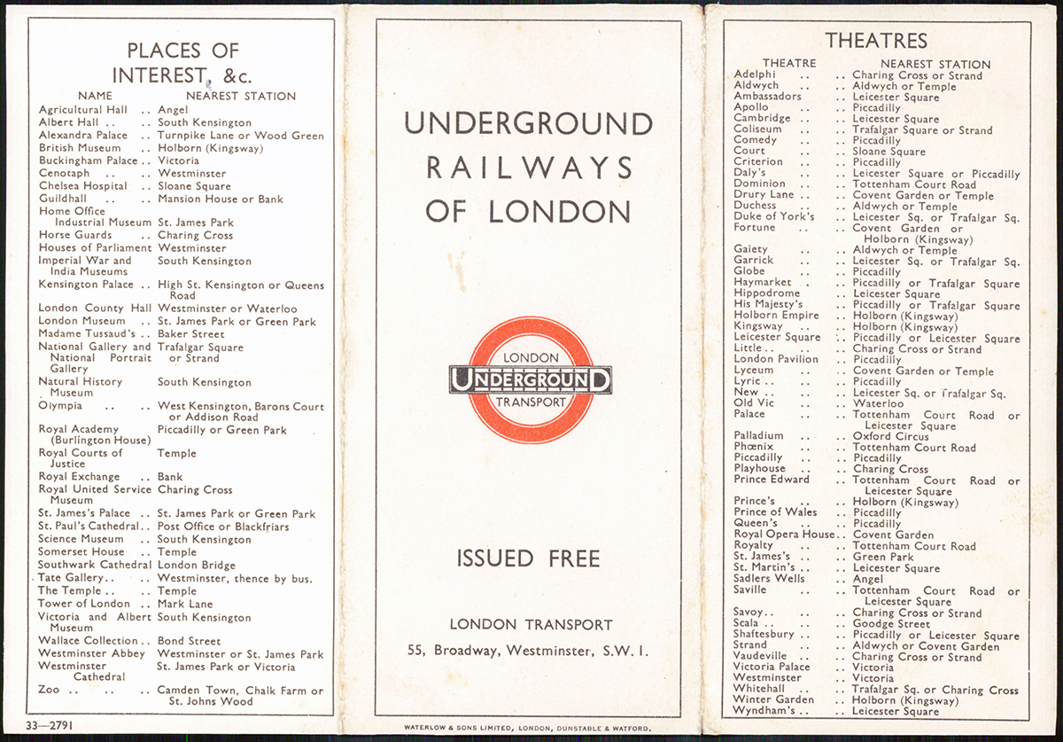
The District line is only shown as far as Bow Road, with an arrow to indicate that the line continues eastwards, the Metropolitan line also has an arrow to show that the line extends to the West of Rickmansworth, with a list of the stations to Aylesbury. The District line is not shown between Ealing Common and South Harrow and the line between Hammersmith and Acton Town is drawn at a 45 degree angle. The Metropolitan line to Stanmore has also been changed to 45 degrees, as well as the sections at Paddington Praed Street and Covent Garden. There are changes in station names, Praed Street is renamed Paddington Praed Street, and the closed British Museum is no longer shown. Interchanges are represented as circles and the escalator connection between Bank and Monument is highlighted in a red box. The logo on the map has been amended with the title London Transport being added inside the circle of the roundel, above and below the UndergrounD bar. On the reverse are lists of places of interest and theatres. The map includes the "Middle Circle", an underground train line using the West London Railway between Latimer Road and Earls Court, passing through Uxbridge Road and Addison Road. The line closed in 1940 following bomb damage. It was not reopened until 2008 as part of the Overground network.
Overall size 20.5cm x 14.3cm with two folds (for a pocket map), as issued. Condition is good with the upper left margin split on the top fold..
£950.00