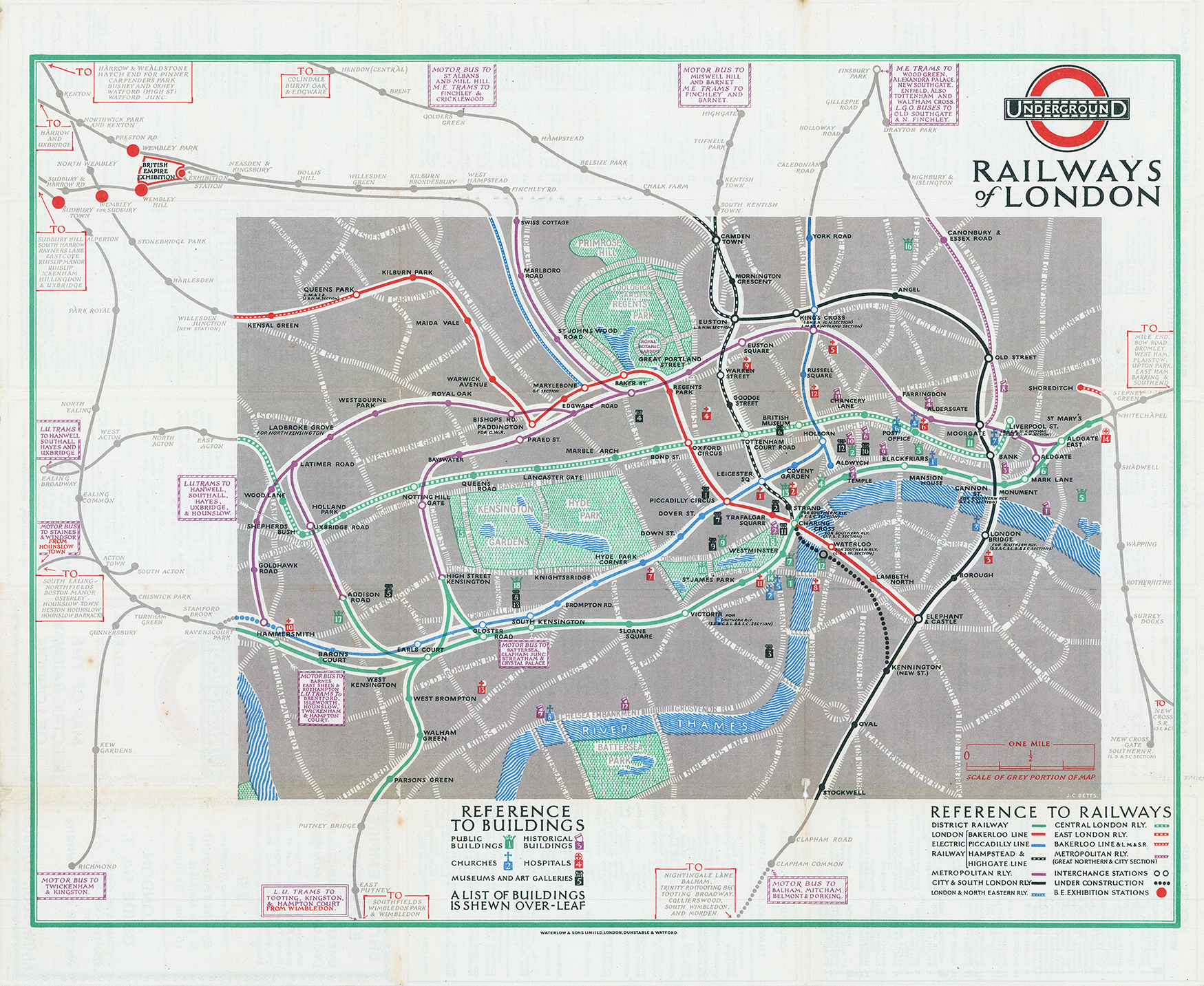
1924 "UNDERGROUND RAILWAYS OF LONDON".
A very scarce example of this early London Underground Map designed by J C Betts.
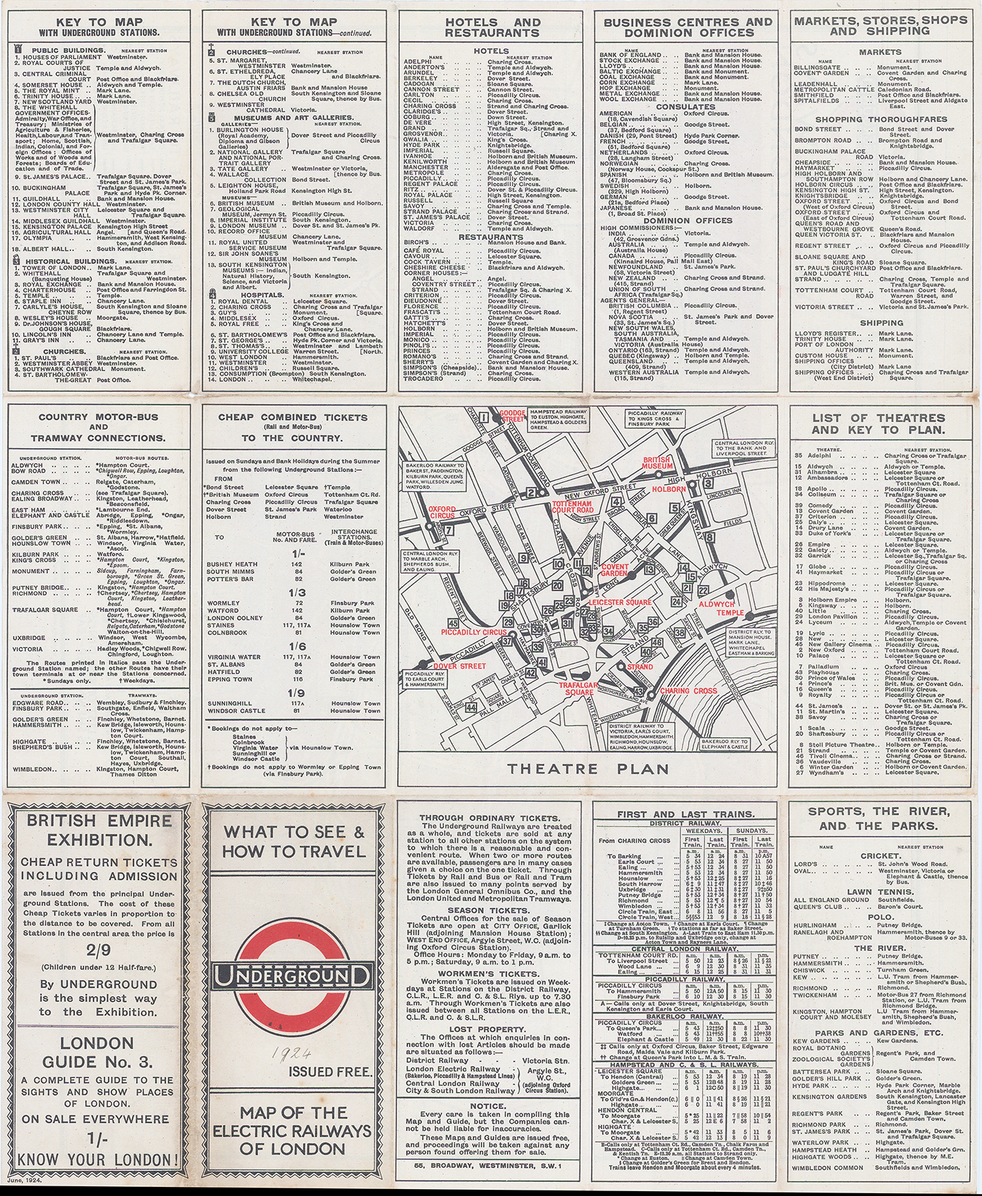
This map was only in use for 1 year before it was replaced by the map designed by Stingemore. 1924 issue of Betts’ 15 panel central area map of the London underground, Size 37.2 x 45.4 cm, printed in colours, information for passengers printed on verso.
The continuation of lines in the margins is not drawn to scale, and Dodd questions the legibility of aspects of the map, but describes the central area as ‘elegantly rendered. The list of attractions include the BRITISH EMPIRE EXHIBITION and there is an inset Theatre Plan Map in the West End. Condition is generally fine with some paper splits along a few of the folds.
£250.00