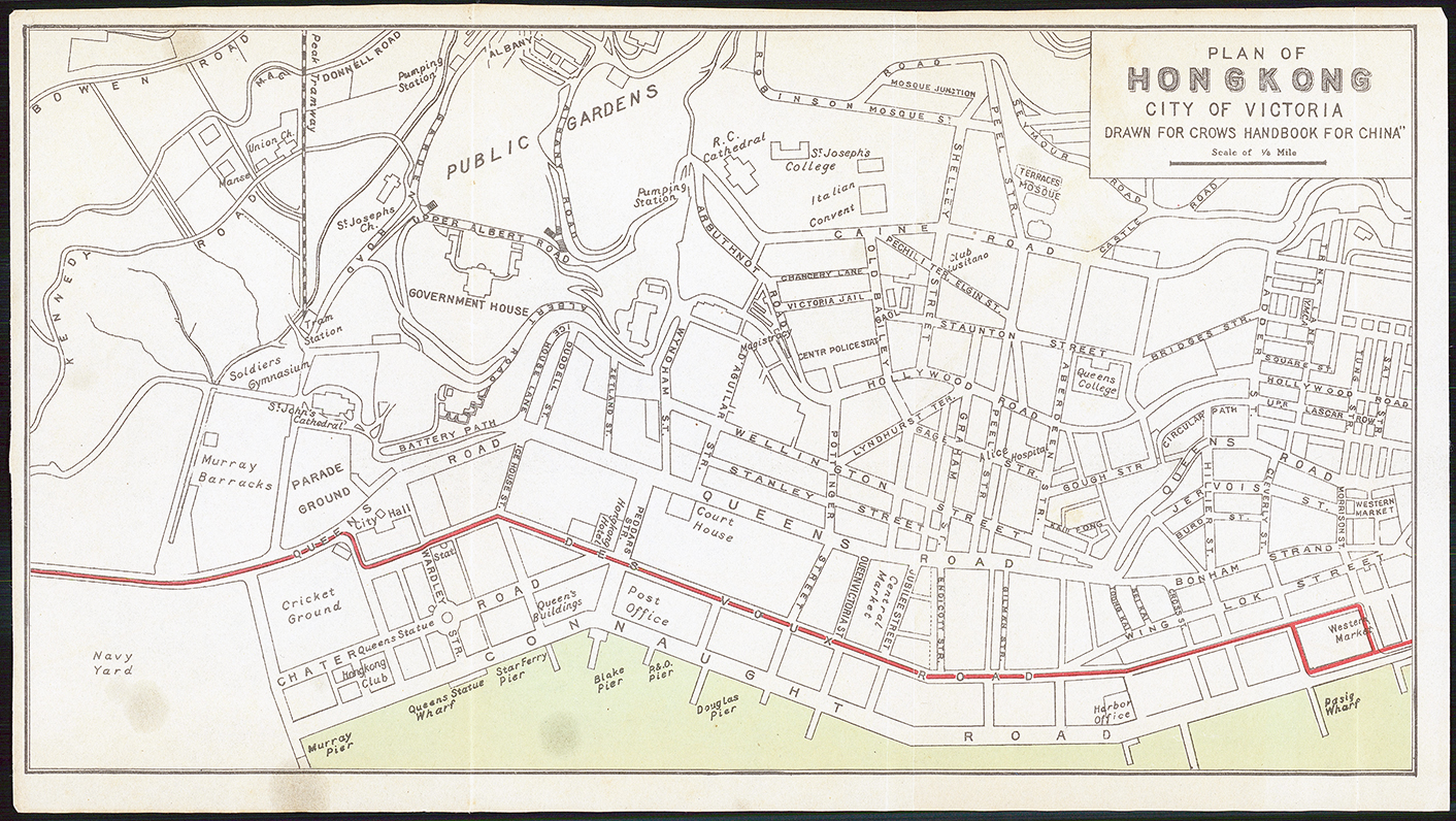
1921 "PLAN OF HONG KONG CITY OF VICTORIA DRAWN FOR CROWS HANDBOOK FOR CHINA". A fine and rare original antique map of the Carl Crow city map. The map depicts Victoria from Kennedy Road, Bowen Road and the Navy Yard to Hollywood Row and the Western Market and from the public gardens and Robinson Road to Connaught Road and the port. All the streets are labeled, as well as several cathedrals, churches and colleges. The government house is labeled in big block lettering. The Peak Tramway, which scales Victoria Peak, is depicted on the left side of the map, along with the tram station. Victoria was the de facto capital of Hong Kong during the British Colonial Period. Per Crow, '....outside of official documents, one rarely hears the name Victoria, the city being commonly given the name of the Island - Hong Kong'.
This map was published by Carl Crow in his HANDBOOK FOR CHINA in 1921. Overall size approx 29.5 x 16.5cm. Condition is generally fine with some mild ageing and occasional tone spots.
Carl Crow (1884-1945) was born in Missouri and is known for, among several achievements, opening the first Western advertising agency in Shanghai, China. Crow arrived in Shanghai in 1911, where he lived for 25 years. He worked as a journalist, newspaper proprietor and advertising agent, while also spending time as a hostage negotiator, police sergeant, farmer and a liaison for the US Government.