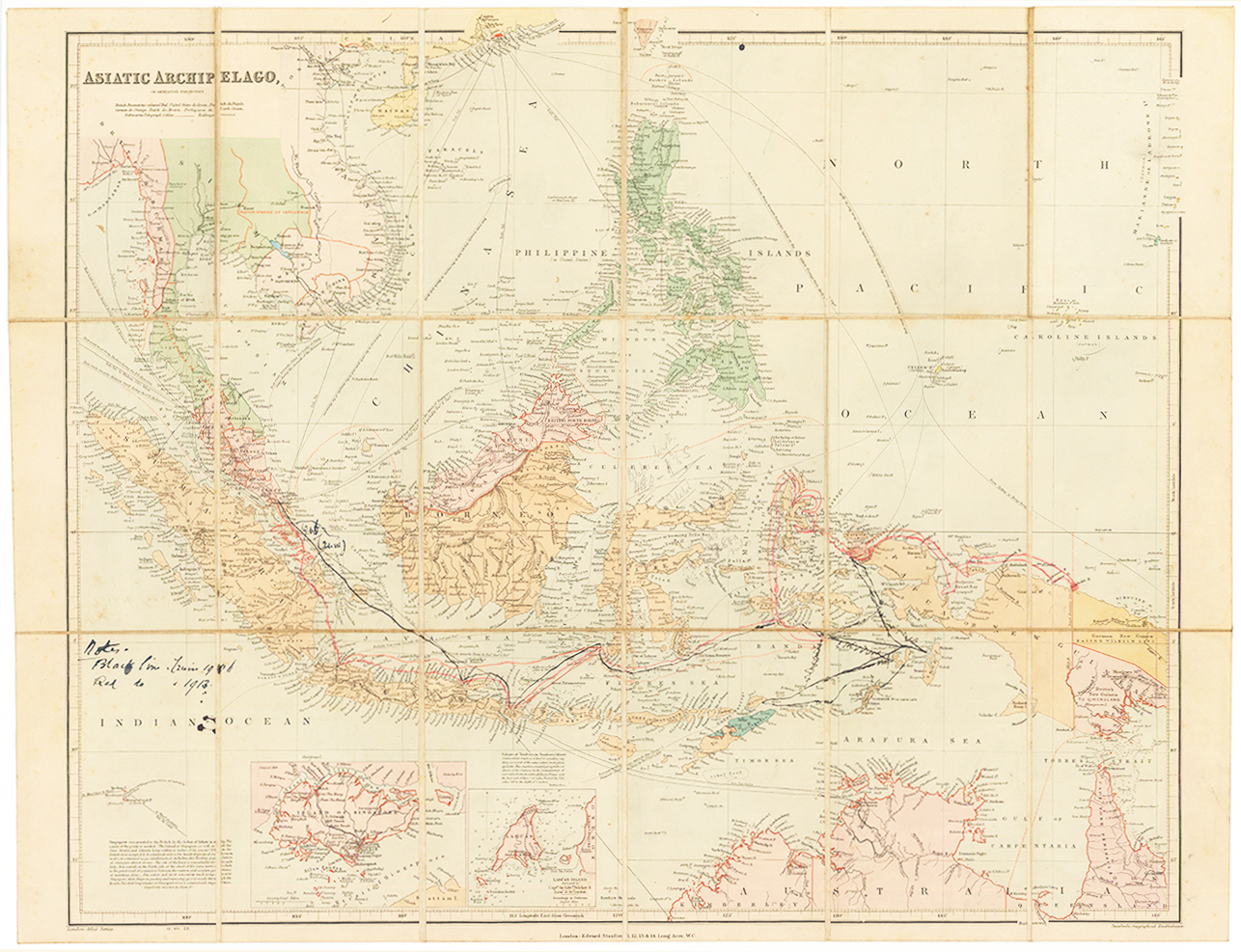
1899 "ASIATIC ARCHIPELAGO on MERCATOR'S PROJECTION".
A fine original antique folding map dissected into 18 sections and laid to linen - of Southeast Asia at the end of the nineteenth century Chromolithographed map. Stanford's map of the East Indies, with the various possessions of European countries in different colours. There are inset maps of Singapore and Labuan, with a note to the left of the map of Singapore recording that it was given to the British by the Sultan of Johore in 1819. There is another note next to Indonesia recording the volcanic eruption in Sumbawa in 1815. The map is criss-crossed by lines showing the best routes between various ports.
Published by Edward Stanford. Overall size approx 52 x 68cm. Condition is generally good. There are some historical manuscript notes and lines in black ink.