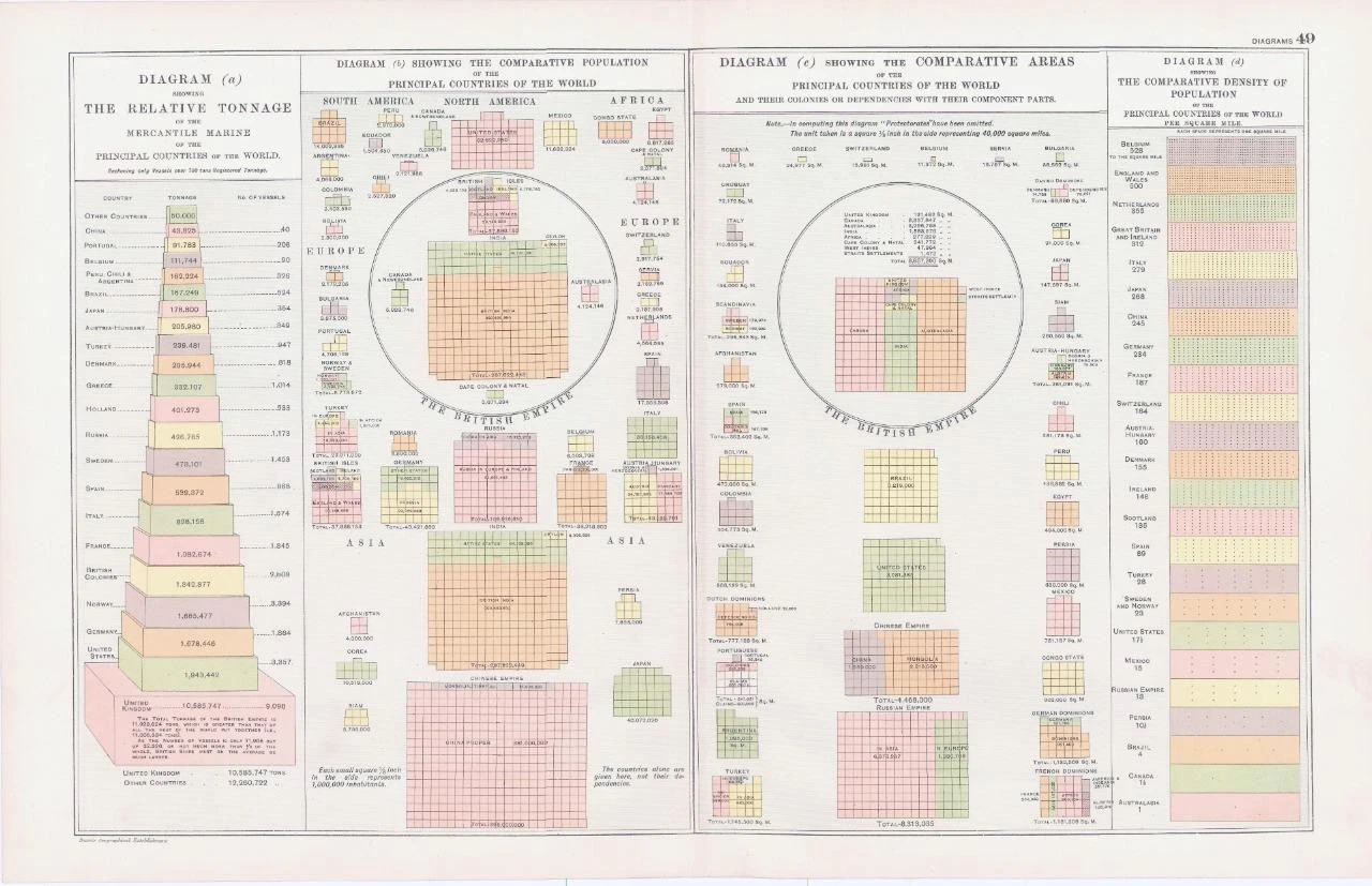
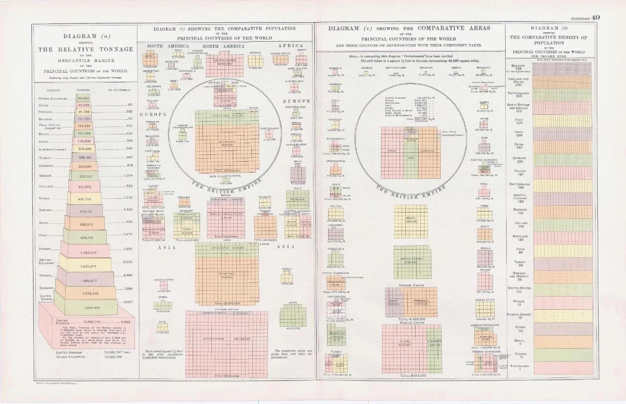
1893 - Large original colour print titled: " DIAGRAM (a) showing THE RELATIVE TONNAGE of the MERCANTLE MARINE of the PRINCIPAL COUNTRIES of the WORLD, DIAGRAM (b) SHOWING THE COMPARATIVE POPULATION of the PRINCIPAL COUNTRIES of the WORLD, DIAGRAM (c) SHOWING THE COMPARATIVE AREAS of the PRINCIPAL COUNTRIES of the WORLD, DIAGRAM (d) SHOWING THE COMPARATIVE DENSITY OF THE POPULATION "
Provenance: Taken from ' Bacon's Popular Atlas of The World ' published and edited by George W Bacon, 127 Strand, London.
Excellent condition with central fold as issued.
Size of map approximately 49cm x 35cm (19.5in x 13.5in) including margins.
£24.20