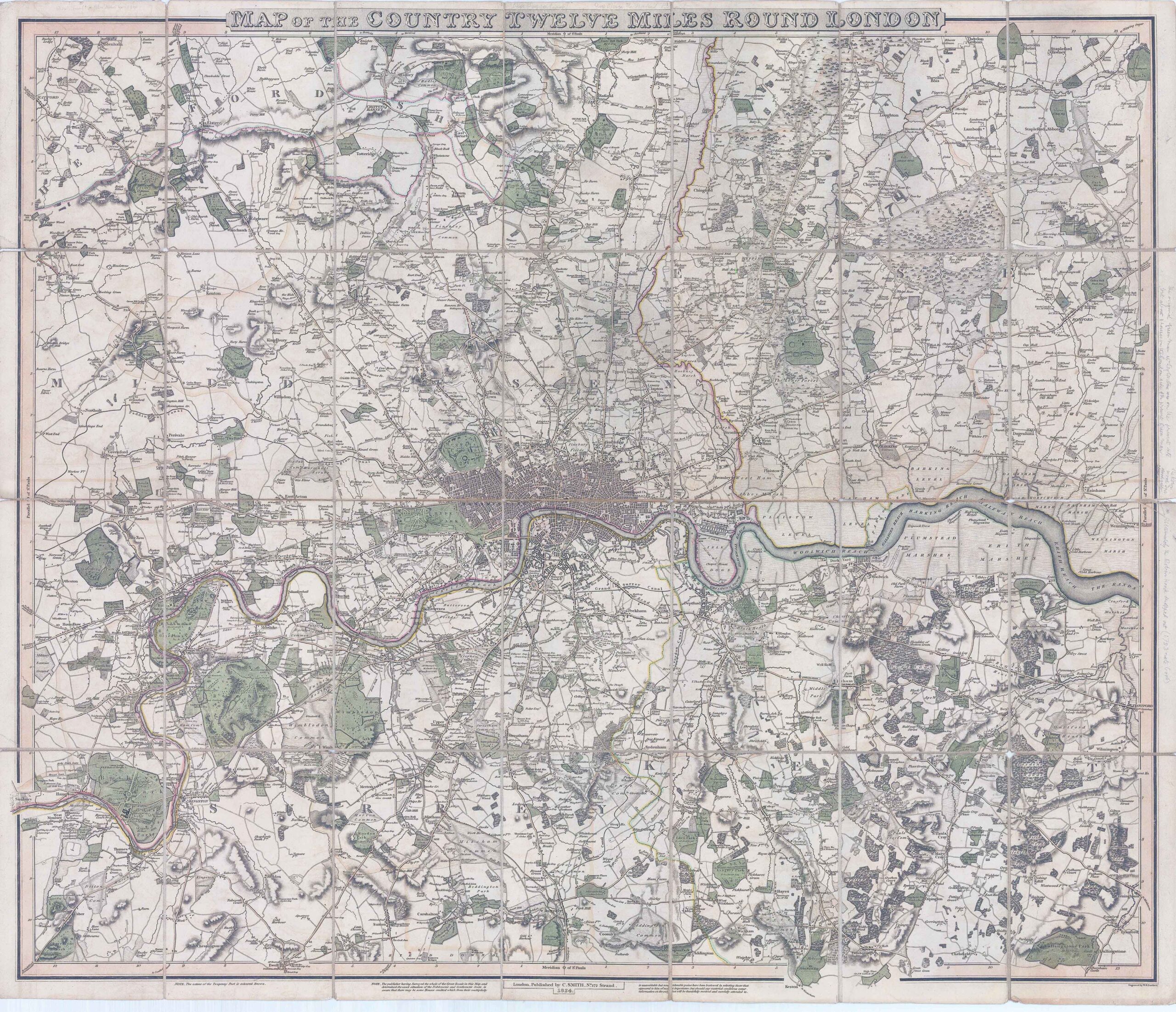
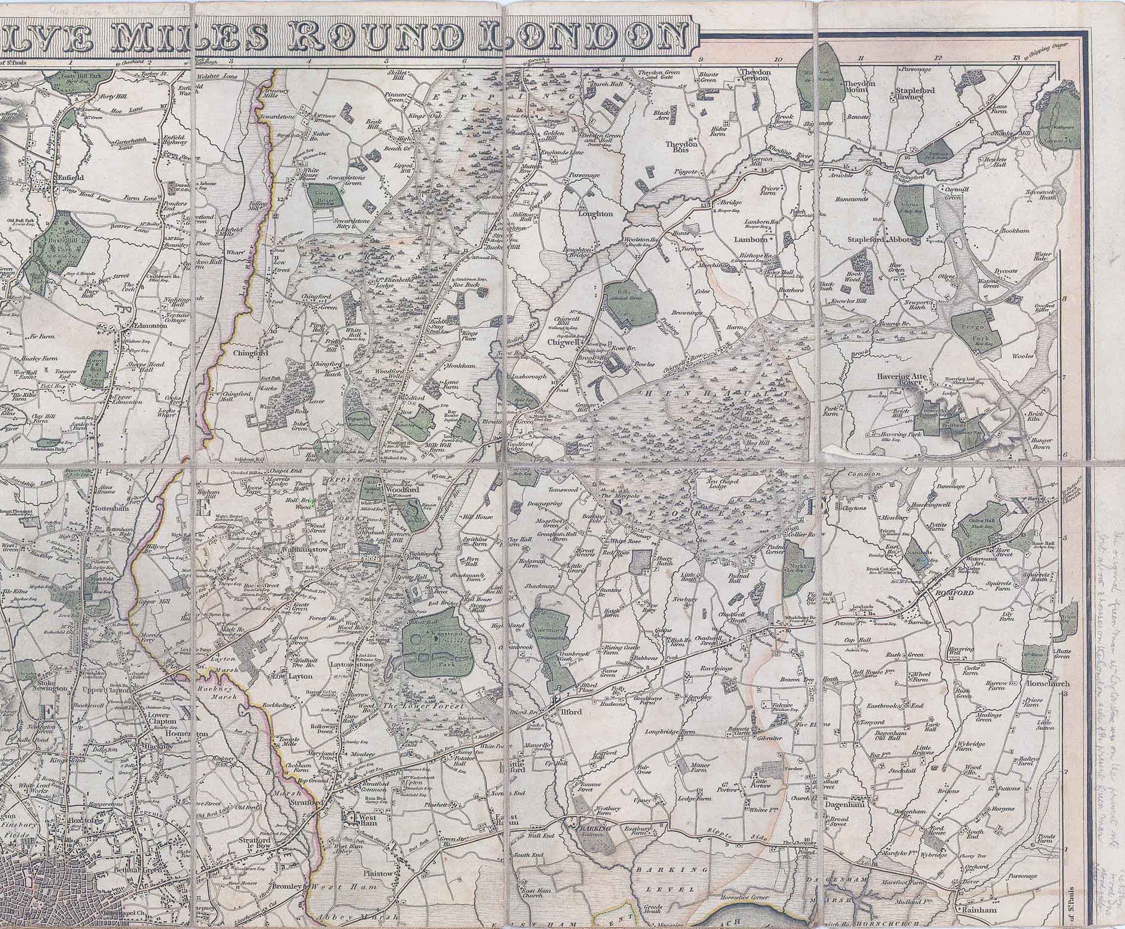

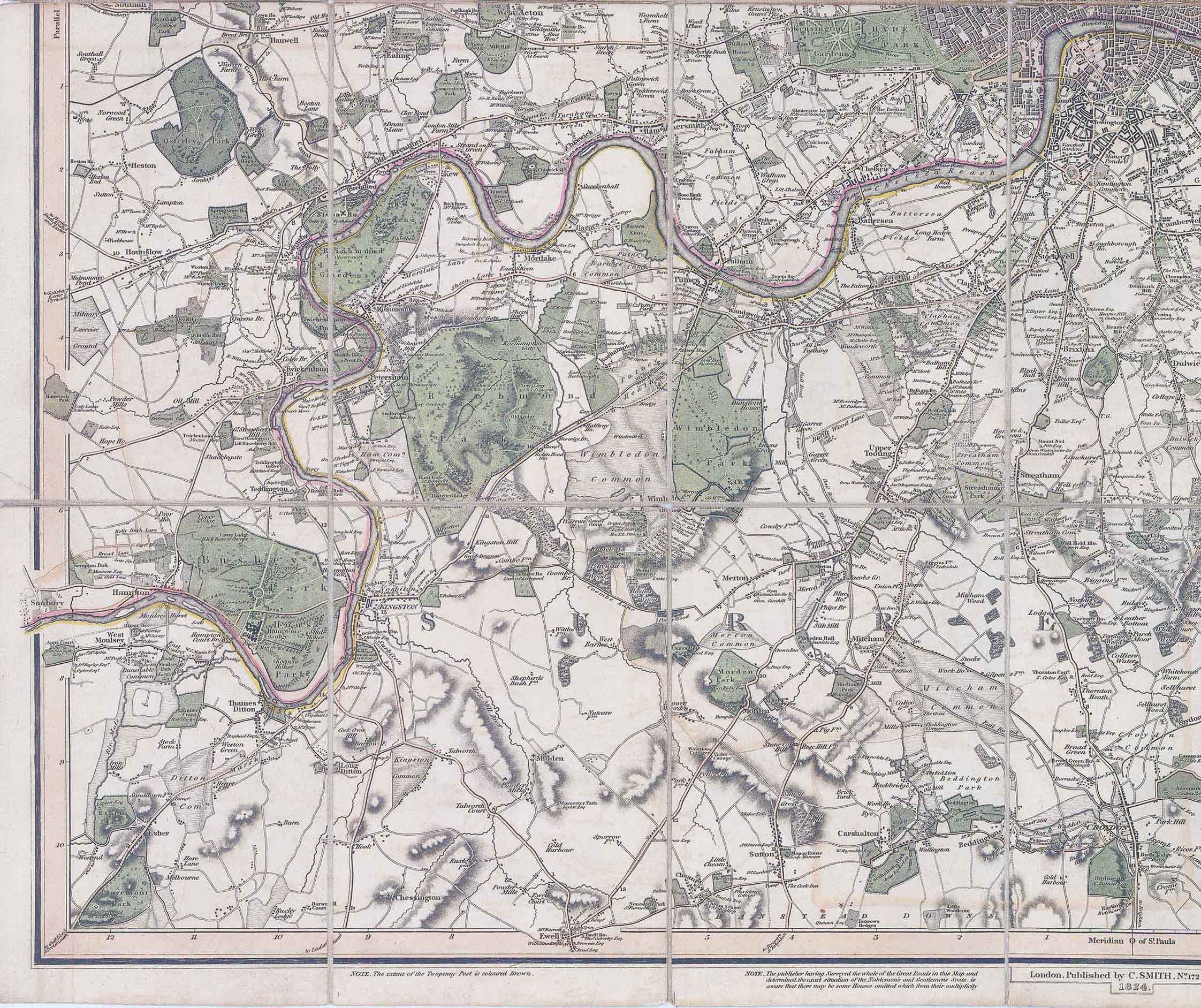
1824 "MAP OF THE COUNTRY TWELVE MILES ROUND LONDON - London Published by C SMITH, No 172 Strand 1824 - Engraved by W R Gardner".
A fine example of this map, dissected into 28 sections and laid to linen. Folding map of London and environs, showing the extents from Enfield Wash through to Banstead Downs and Hornchurch through to Southall.
Original colour in wash and outline, the parks and large estates coloured in green; the county boundaries in pink and yellow. Many of the places, seats and estates are accompanied by the name of their owners. In a printed note in the lower margin the publisher notes that "having Surveyed the whole of the Great Roads in this Map, and determined the exact situation of the Noblemen's and Gentleman's Seats, [he] is aware that there may be some Houses omitted which from their multiplicity is unavoidable, but considerable pains have been bestowed in selecting those that appeared to him of most importance, but should any material omissions occur, information on the subject will be thankfully received and carefully attended to.
Overall size approximately 89cm x 75cm.
Condition is good with some splits to part of the linen joins but all the map is present with no missing pieces.
Howgego No 288 - though this example of 1824 is NOT listed.
£425.00