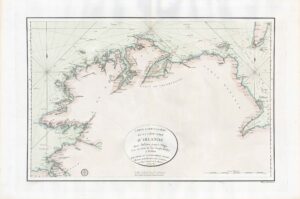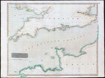
1814 - A large original engraved map titled: " The British Channel "
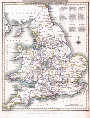
A fine original engraved map with original hand colour originally published in "A new general atlas, consisting of a series of geographical designs, on various projections, exhibiting the form and component parts of the globe; and a collection of maps and charts, delineating the natural and political divisions of the empires.............." Printed by George Ramsay and Company for John Thomson and Company, Edinburgh and published in 1817.
Excellent condition with central fold as issued.
Size approximately 73cm x 54 cm.