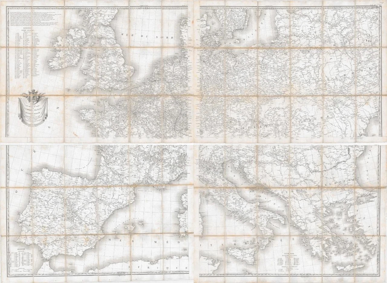
1814 -" CARTE DES ROUTES DE POSTES de L'EMPIRE FRANCAIS du ROYAUME D'ITALIE et de la CONFEDERATION DU RHIN Dressee par ordre....... "
Tardieu's magnificent, engraved map of Western Europe under French Dominion, focusing primarily on political divisions and post roads.
The map was published in the first year of the War of the Sixth Coalition (May 1813 - May 1814), which would eventually see Napoleon deposed and sent into exile on Elba. After the disastrous French invasion of Russia of 1812, the continental powers joined Russia, the United Kingdom, Portugal and the rebels in Spain who were already at war with France.
Set of 4 Maps each dissected into 18 sections laid to linen.
Each sheet measuring 85cm x 62cm and if all joined together would measure 170cm x 124cm.
Overall condition is good.
There is the expected age toning and spots and there is some fraying along the edges of the folds.
£385.00