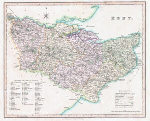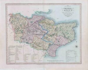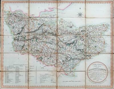
1807" LAURIE & WHITTLE'S New Map of the County of Kent Divided into its Laths with their modern Subdivisions. exhibiting the Whole of the Mail, Direct & Principal Cross Roads - Gentlemens Seats, Navigable Canals, Rivers &c. Laid down from Astronomical Observations Published in the Philosophical Transactions - By - NATHL. COLTMAN 1807 - Published July 20th 1807 by Robt Laurie & Ja.s Whittle, 53 Fleet Street, London "
A good example of this scarce folding map of Kent by Nathaniel Coltman. Dissected into 20 pieces and laid to linen with original hand colouring & measuring 68cm x 54cm. With original slip case.
Condition is good though there are some small holes in a couple of the folds with some of the pieces starting to detached from the linen. The slip case is rather sorry for itself but original title label is intact. A very presentable example of this rarer map.
£250.00