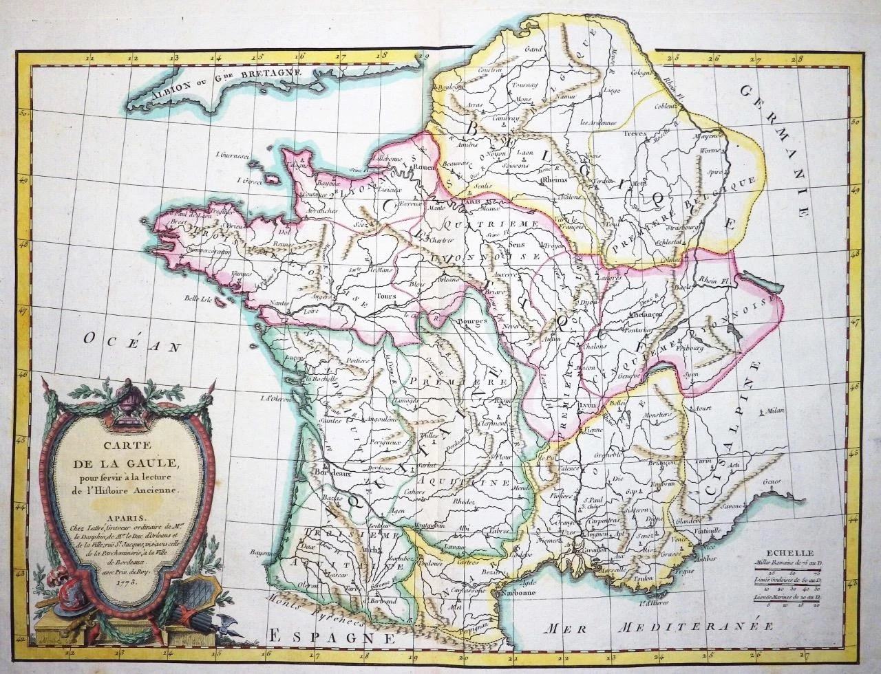
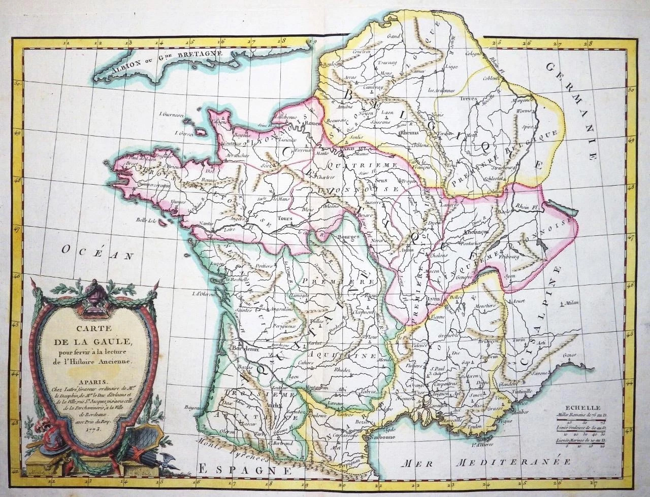
1773 - A fine and rare original antique map titled: ' Carte de la GAULE pour servir a la lecture de l'Histoire Ancienne '
Provenance: Taken from "Atlas Moderne ou collection de Cartes sur toutes les parties du Glove Terrestre" by Jean Lattre.
Overall size of the map is 48cm x 36cm with large margins.
Condition is excellent with original and later hand colour and with central fold as issued and blank on verso.
An appealing 1763 map of Gallia or France in ancient Roman times by the French cartographer Rigobert Bonne. Covers the region from southern part of England (Britannia) to the Pyrenees and the Mediterranean. Details mountains, rivers, cities, roadways, and lakes with political divisions highlighted in outline color.
Gaul or Gallia was the ancient name of a region of Western Europe which comprises of modern day France, Luxembourg, Belgium, most of Switzerland and Germany west of the Rhine. After the Gallic Wars of 58-51 BC, all of Gaul came under the control of the Romans. It continued under Roman control for almost 500 years before it fell to the Franks in AD 486. The Gallic Wars are believed to have been fought primarily to provide Caesar with wealth and popularity and to boost his political career rather than being a defensive action as described by Caesar. The campaigns are described by Caesar in his book COMMENTARII DE BELLO GALLICO.
A decorative title cartouche appears in the bottom left hand quadrant.
£90.00