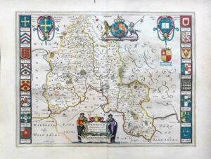
1770 - "OXFORDSHIRE described with Ye Citie and the Armes of the Colledges of ye famous University".
A fine example of this John Speed Map of Oxfordshire showing the coats of arms of the various university colleges (with the supposed dates of their foundation), inset map of the city and a separate key with 28 listed landmarks. The arms of the earl of Oxford to the right. Two academic university figures are seen standing with a pair of compass dividers either side of a striking globe, representing the scale of miles. A strapwork border design and the royal coat of arms complete this map.
After the publication of the 'Theatre' in 1676 by Bassett & Chiswell, the plates then passed via Christopher Browne to Henry Overton who published a new edition of the atlas. Roads were later added to the plates and widespread retouching of the engraved lines was carried out before the plates were passed on again on to W. and C. Dicey some time around 1754 when they issued their 'Dicey Catalogue'. Due to the very small number of atlases published by them, together with the high mortality rate of the few loose sheets they issued, these late impressions of the map are extremely scarce, more so than all of the earlier editions.
Overall size including margins approximately 55cm x 40cm.
This example has been rebacked (historically), to preserve and also add margins. The original map was trimmed to the margin line. On laying the map onto the backing, some repairs are showing in a few small areas around the original folds. Later hand colour.
£1,000.00