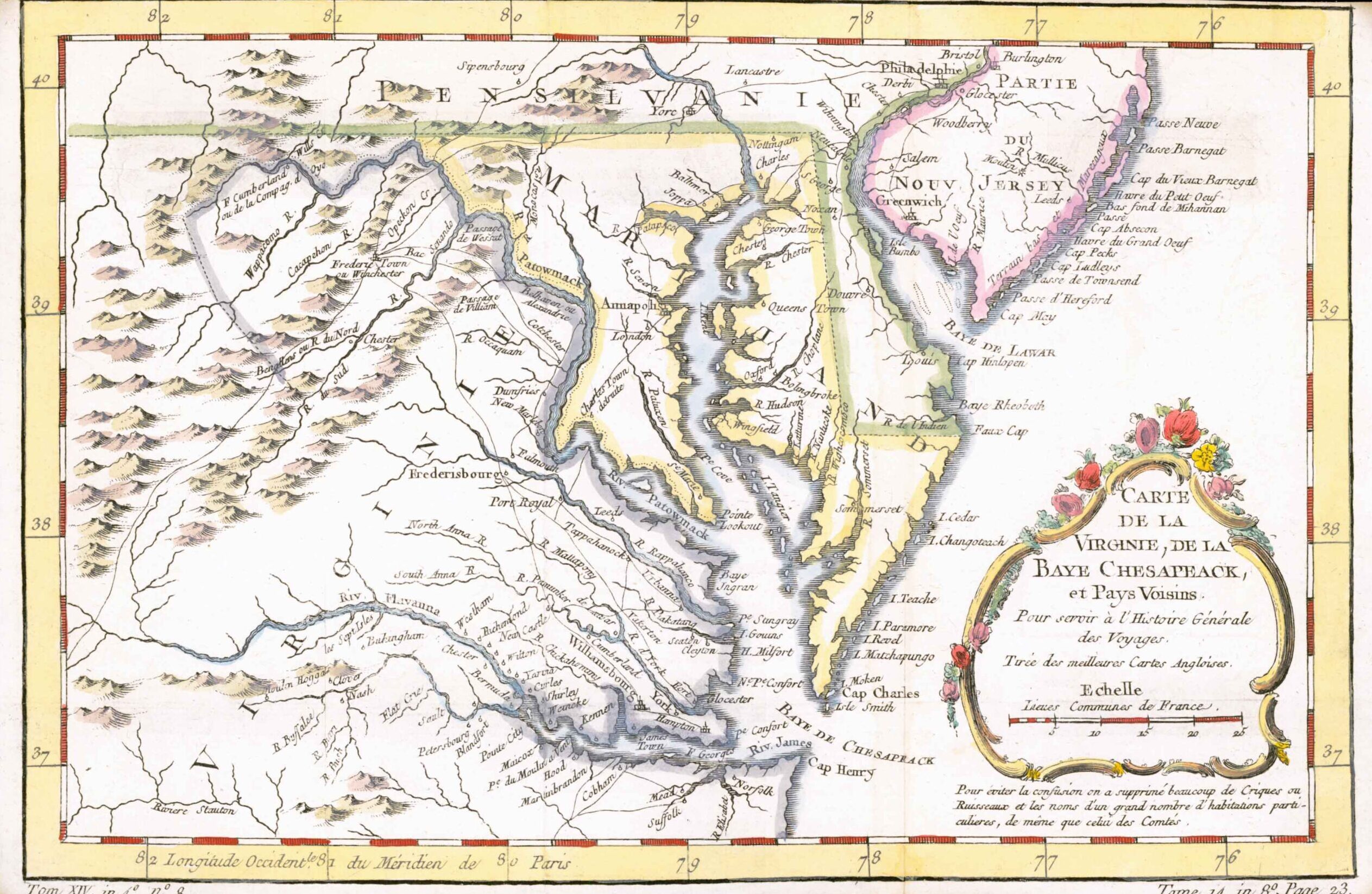
1770 - "CARTE DE LA VIRGINIE, DE LA BAYE CHESAPEACK ET PAYS VOISINS".
A fine early map of Detailed map of the Chesapeake, Virginia, Maryland, Delaware (immediately prior to the settlement between Penn and Lord Baltimore, with Delaware properly shown as part of Pennsylvania), and contiguous regions.The map shows towns, roads, villages, churches, meeting houses, rivers, mountains, inlets, islands and a host of other details. By Nicolas Bellin and published for "Histoire Géneral des Voyages".
Jacques Nicolas Bellin (1703 – 21 March 1772) was a French hydrographer and geographer. During his career of over 50 years he produced a large number of maps for, among others, the French Ministry of Navy.
Size approximately 30cm x 19.5cm with several folds as issued.
Generally good condition with later hand colour.
£340.00