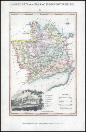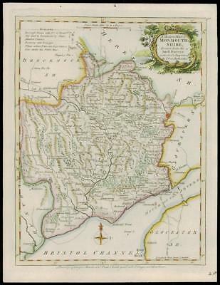
1768 - A fine original antique map by John Ellis titled: " A Modern Map of MONMOUTHSHIRE "
An attractive antique engraved map taken from 'ELLIS'S ENGLISH ATLAS: OR A COMPLEAT CHOREOGRAPHY OF ENGLAND AND WALES" published by Robert Sayer and Thomas Jeffrey, London 1768. Decorative title cartouche and expert hand colouring.
Overall size approximately 21.5cm x 28cm.
£50.00