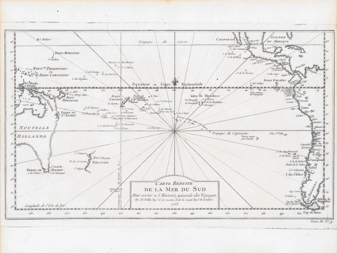
1753 - ' CARTE REDUITE DE LA MER DU SUD Pour servir a L'Histoire generale des Voyages. Per M Bellin Ingr de la marine, et de la Societe Roy de Londres 1753 '
An important map of Australia and New Zealand. Australia is attached to New Guinea and Tasmania attached to the mainland. The east coast is entirely imaginary. New Zealand includes only its western coast in an incomplete fashion. This map is remarkable in its historical significance, timed only a few years before the commencement of an intense campaign by the English and French to explore and map Oceania and the South Pacific. Extends from the Marianas and Carolines to the coast of America, including Baja California, the Gulf of Mexico, Central America and much of South America, including the Straits of Magellan and Cape Horn.
A very fine example of this essential collector's map.
Approx size 36.7 x 28cm including margins.
Excellent condition.
Jacques Nicolas Bellin (1703-1772) was among the most important mapmakers of the 18th century. In 1721, at age 18, he was appointed hydrographer (chief cartographer) to the French Navy. In August 1741, he became the first Ingenieur de la Marine of the Depot des cartes et plans de la Marine (the French Hydrographic Office) and was named Official Hydrographer of the French King. During his term as Official Hydrographer, the Depot was the single most active centre for the production of sea charts and maps, including a large folio format sea-chart of France, the Neptune Francois. These gained fame, distinction and respect all over Europe and were republished throughout the 18th and even in the succeeding century.
Bellin also came out with smaller format maps such as the 1764 Petit Atlas Maritime, containing 580 finely detailed charts. He also contributed many of the maps for Bellin and contributed a number of maps to the 15-volume Histoire Generale des Voyages of Antoine Francois Prevost or simply known l'Abbe Prevost. Bellin set a very high standard of workmanship and accuracy, this gaining for France a leading role in European cartography and geography. Many of his maps were copied by other mapmakers of Europe.
£580.00