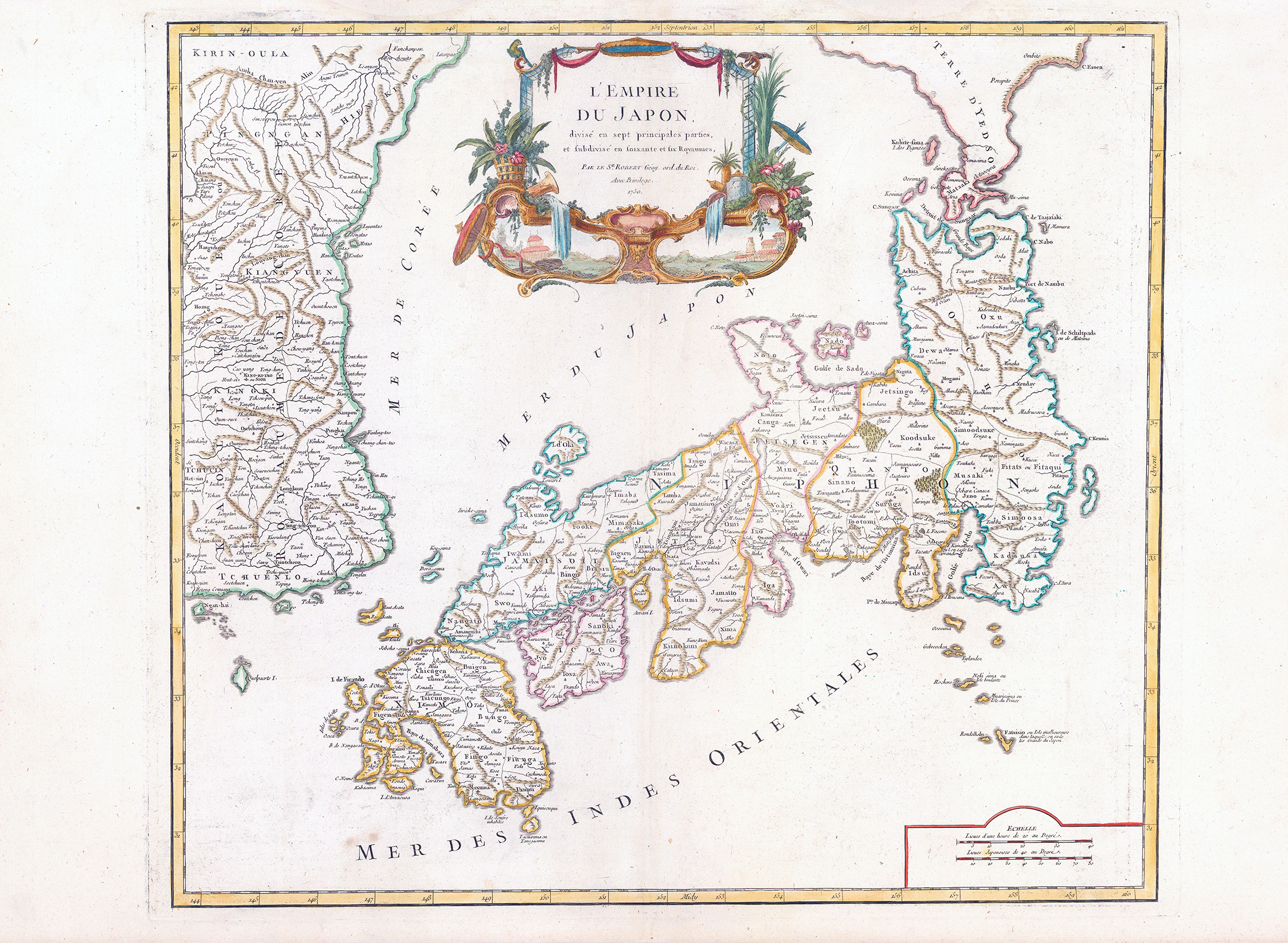
1750 - "L'Empire du Japon divise en sept principales parties, et subdivise en soixante et six Royaume......" by Gilles Robert de Vaugondy.
A fine First edition of this rare map of Japan and part of Korea. It shows the archipelago in detail, with portions of the Korean Peninsula and the mysterious TERRE D'YEDSO. The amp includes much of the Korea Peninsula, which is just as detailed as the archipelago of Japan to the east. Japan is divided into political units, as the title indicates. The title translates to, " The Empire of Japan, divided into seven principal parts, and subdivided in sixty and six kingdoms ". The divisions include provinces with the principal towns in each indicated. To the west of Japan is both the Sea of Korea (Mer de Coree). The name of this body of water had long been disputed and is still a matter of contention today.
Vaugondy erred on the side of including both names. "Terre D'Yedso" is a reference to Jesso, a feature including on many seventeenth and eighteenth-century maps. Historically Eso (Yeco, Jesso, Yedso, Yesso) refers to the island of Hokkaido. It varies on maps from a small islands to a near-continent sized map that stretched from Asia to Alaska.
The title is contained in an elaborate cartouche which showcases the bounty and beauty of Japan. A double scale bar is included in a simple cartouche in the lower right corner.
Overall size approximately 73cm x 52cm including margins.
Condition is excellent with central fold as issued.
Gilles Robert de Vaugondy (1688-1766) was the head of a leading family of geographers in eighteenth century France. Gilles got his start when he jointly inherited the shop of Pierre-Moullart Sanson, grandson of the famous geographer Nicholas Sanson. The inheritance included the business, its stock of plates, and a roller press. In 1760 Gilles became geographer to King Louis XV. His son, Didier Robert de Vaugondy (ca. 1723-1786), was also a geographer and the two worked together. They were known for their exactitude and depth of research. In 1757, they produced the Atlas Universel, considered an authority for many years.
£800.00