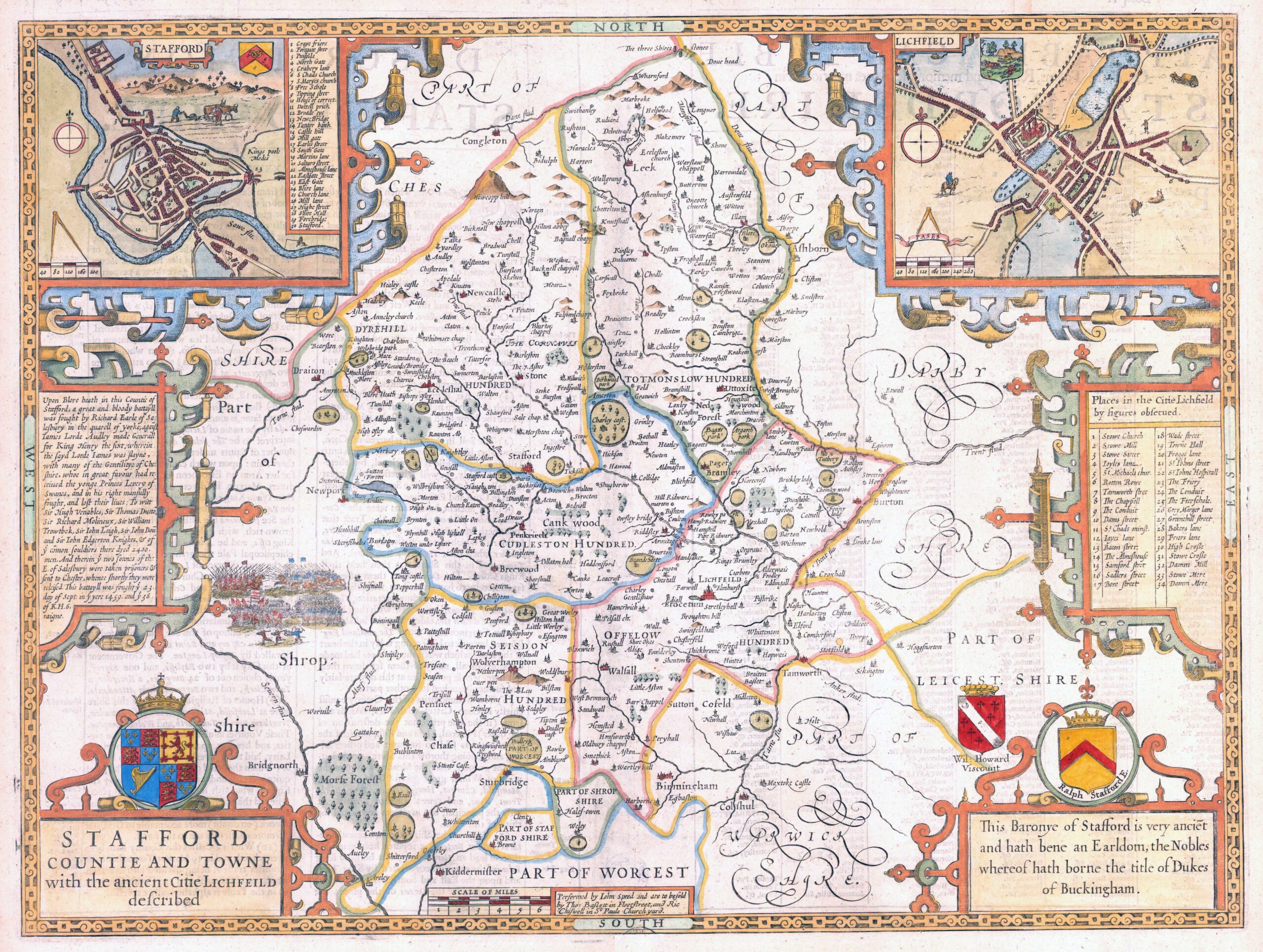

1676 - "STAFFORD COUNTIE AND TOWNE with the ancient Citie Lichfield described".
A highly decorative map of Staffordshire with an inset birds-eye views of Stafford and Lichfield, Tables of places in Stafford & Lichfield, Decorative cartouche & coats of arms. This is the edition published by Thomas Bassett & Richard Chiswell.
Condition is generally very fine with central fold as issued with English text on verso.
Size 53cm x 41.5cm including the margins and with later hand colour.
John Speed (1552-1629) is the most famous of all English cartographers primarily as a result of The Theatre of the Empire of Great Britaine, the first Atlas of the British Isles. The maps from this Atlas are the best known and most sought-after of all county maps. The maps were derived mainly from earlier prototypes fo Christopher Saxon and Robert Norden but with notable improvements include parish "Hundreds" and county boundaries, town plans and embellishments such as the coats of arms of local Earls, Dukes and the Royal Household.
£425.00