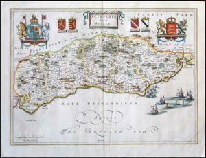
1654 - "SUTHSEXIA VERNACULE SUSSEX"
A highly decorative and sought after engraved 17th Century Map of Sussex showing Royal Coat of Arms at top left & right with Coats of Arms of the Noble families of the Counties each side of the central title cartouche. The map itself is filled with details of the countryside including forests, parks, towns and villages. The reverse of the map is a complete set of text in French describing the history and topography of the county.
Measures 450 x 570 mm with early hand colouring.
Condition is generally good with some overall light age toning on the front, along with a few scattered tone spots.