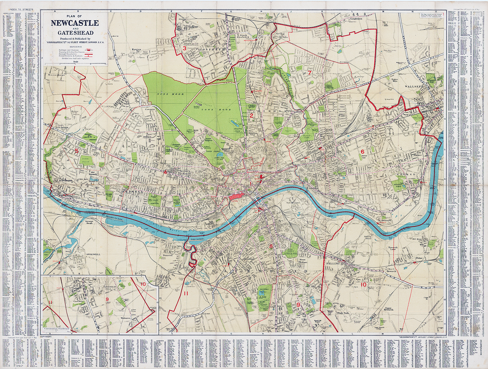
1920s - "A PLAN OF NEWCASTLE AND GATESHEAD Produced & published by GEOGRAPHIA Ltd, 167 Fleet Street, London EC4"
A fine large original antique folded map, linen backed, published by Geographia. The map details the urban layouts of Newcastle upon Tyne (north of the river) and Gateshead (south of the river), distinctly divided by the winding River Tyne flowing through the centre. It is framed by a comprehensive index of streets along the left, right, and bottom borders to help users pinpoint specific locations using grid references. Prominent green spaces are visible on the map, including the expansive Town Moor and Nuns Moor in the upper-left quadrant. Large numbered red regions mark specific districts or postal boundaries across both municipalities.
Overall size approx 65 x 101.5cm. Condition generally fine with mild ageing as expected.
£125.00