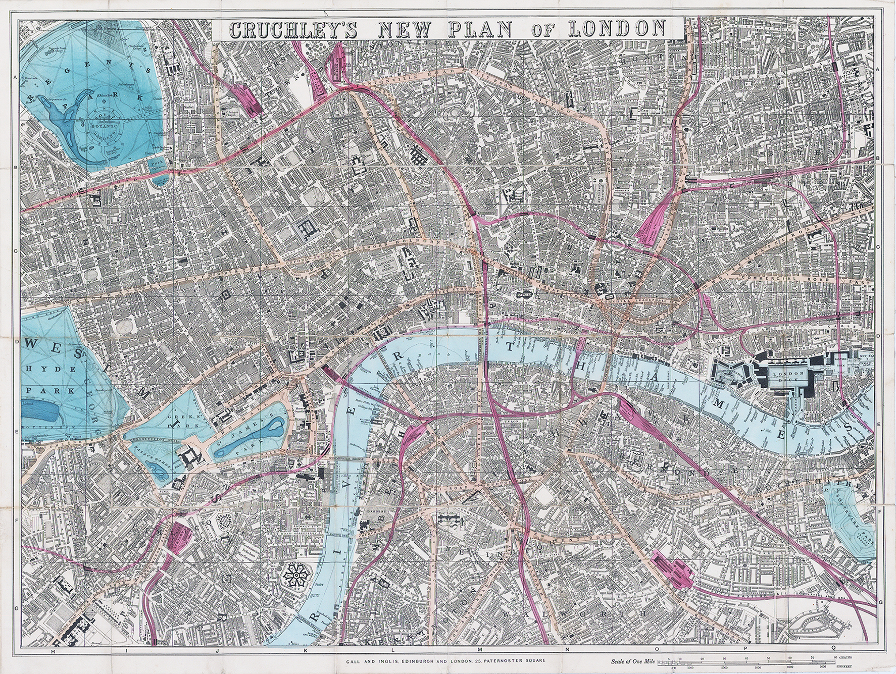
1860 "CRUCHLEY'S NEW PLAN OF LONDON" A fine first-edition of George Frederick Cruchley's 1860 folding pocket map of London. The map captures the city of the city-wide 19th century urbanisation that coincided with the Industrial Revolution. Overall size 65 x 48.5cm. Condition is excellent & laid to linen.
Centered on Blackfriars Bridge, the map covers from Regent's Park to Chelsea Hospital and from Hyde park to Southwark Park. Streets, bridges, wharves, docks, parks, the imprints of important buildings and railway stations are identified throughout. The map gives particular attention to the railways, highlighted in red, that were being developed throughout London at the time. A purple border outlines the City of London.
George Frederick Cruchley (1797-1880) was a London based book and map seller active in the middle part of the 19th century. Cruchley began his cartograph career as an apprentice at the venerable Aaroon Arrowsmith firm. Many of Cruchley's earliest maps beat the words 'From Arrowsmith's' on the imprint. In 1844, Cruchley acquired the massive stock of the important early 19th century firm of John Cary. Cruchley published his own maps as well as reissues of Carlys stock well into the 1870s. He is best known for his detailed plans of London, which in recent years have become increasingly scarce and desirable. Cruchley was based in London on 38 Ludgate Street until 1834 when he moved his offices to 81 Fleet Street. Shortly before his death in 1880, Cruchley auctioned his entire stock. Many of his map plates were acquired by 'Gall and Inglis' who continued the Cruchley tradition well into the early 20th century.
£275.00