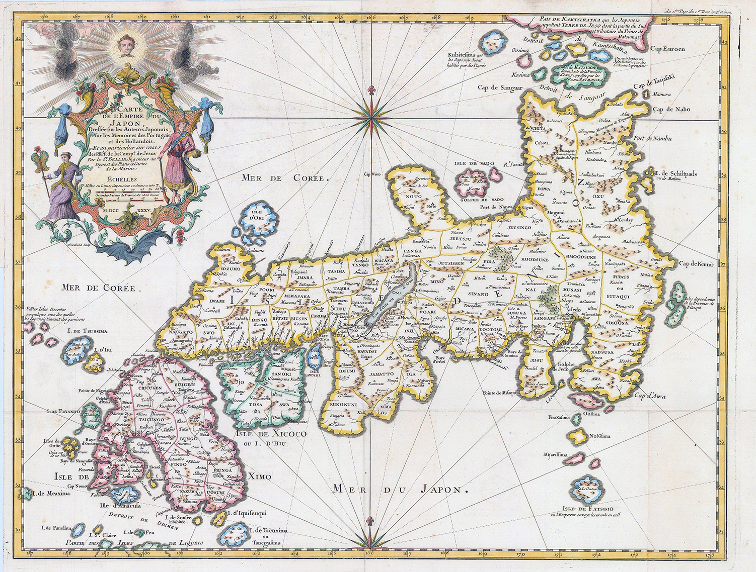
1754 - "CARTE DE L'EMPIRE DU JAPON DRESSEE SUR LES AUTEURS JAPONOIS, SUR LES MEMOIRES DESPORTUGAIS ET DES HOLLANDOIS ET EN PARTICULIER SUR CEUX DES RRPP de la comp. de Jesus".
This is Jacques-Nicolas Bellins 1735-1754 map of Japan, published in Pierre Francois Xavier de Charlevoix's "Histoire et description generale du Japon", an influential work thoughout the 18th century. Centered on the Bay of Osaka, coverage ranges from the northern islands of Japan (Ezo) to the Ryuku Islands, which were vassals of Satsuma (Saxuma) Domain. Various towns, harbours, bays, provinces, mountains and daimyo are noted, although many were speculative.
The map includes several inaccuracies. Shikoko Island (here identified as I.Xixoco) appears to be almost square with a deep inlet on its northern side, whilte Kyushu (Insel Ximo) is slanted to the east. On the island of Honshu (Insel Nippon), Aomori Prefecture is foreshortened while the Oki Islands appear exaggerated. Shimane prefecture and the Noto Peninsula are also distorted. The island of Hokkaido is referred to as the 'I. de Matsumay', after the ruling Matsumae clan, which ruled a domain (han) in southern Hokkaido. The Isle de Fatsisio at bottom-right is Hachijo-jima, where political opponents of the shogun (not the Emperor) and other criminals were exiled.
Overall size approximately 60cm x 44cm.
Condition is excellent.
£1,800.00