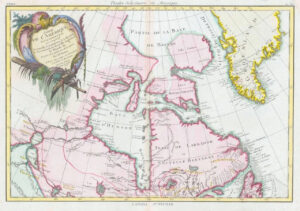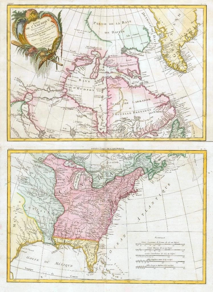
1783 - A fine original antique pair of maps titled: ' Partie de L'AMERIQUE Septentrionale qui comprend le Canada, la Louisiane le Labrador le Greenland, les Etats-Unis et la Floride '
A highly detailed and decorative pair of Maps of the British and Spanish colonies in North America. The maps extend north to Baffin's Bay and west to Lake Ouinipigon (Winnepeg), the known course of the Missouri River and Texas, propviding a nice image of the Great Lakes and the mississippi Vally on the eve of the American Revolution. The various lines denote the boundaries of Canada, Mexique (New Spain, the lands of Hudson's Bay Company and Louisiana. Curiously, no line is shown differentiating Canada from the remaining British Colonies. The boundaries of the British Colonies and East and West Florida are not shown.
Overall size of each map is 48cm x 35cm with large margins, perfect for mounting and framing.
CONDITION: Excellent overall condition with hand colouring and the centrefold, as issued. Blank on verso.
Publisher: Jean Lattre (fl. 1743 - 1793) was a Paris based bookseller, engraver, and map publisher active in the mid to late 18th century. Lattre published a large corpus of maps, globes, and atlases in conjunction with a number of other important French cartographic figures, including Janvier, Zannoni, Bonne and Delamarche. He is also known to have worked with other European cartographers such as William Faden of London and the Italian cartographer Santini. Map piracy and copyright violations were common in 18th century France. Paris court records indicate that Lattre brought charges against several other period map publishers, including fellow Frenchman Desnos and the Italian map engraver Zannoni, both of whom he accused of copying his work. Lattre's offices and bookshop were located at 20 rue St. Jaques, Paris, France.
Cartographers: Rigobert Bonne (1727 - 1794) was one of the most important French cartographers of the late 18th century. Bonne was born in Ardennes at Raucourt, France. He taught himself mathematics and by eighteen was a working engineer. During the War of the Austrian Succession (1740-1748), he served as a military engineer at Berg-op-Zoom. In the subsequent years, Bonne became one of the most respected masters of mathematics, physics and geography in Paris.
In 1773, Bonne succeeded Jacques-Nicolas Bellin as Royal Cartographer to France in the office of the Hydrographer at the Depot de la Marine. Working in his official capacity, Bonne compiled some of the most detailed and accurate maps of the period - most on equal-area projection known erroneously as the 'Bonne Projection'. Bonne's work represents an important step in the evolution of the cartographic ideology away from the decorative work of the 17th century and early 18th century towards a more scientific and practical aeshetic. While mostly focusing on coastal regions, the work of Bonne is high regards for its details, historical importance and overall aesthetic appeal. Bonne died of edema in 1794, but his son Charles-Marine Rigobert Bonne continued to publish his work well after his father's death.
Jean or Robert Janvier (fl. 1746 - 1776) was a Paris based cartographer active in the mid to late 18th century. Janvier true first name is a matter of debate, as it appears as it often appears as either Jean or Robert. More commonly, Janvier simply signed his maps Signor Janvier. By the late 18th century Janvier seems to have been awarded the title of "Geographe Avec Privilege du Roi" and this designations appears on many of his latter maps. Janvier worked with many of the most prominent French, English and Italian map publishers of his day, including Faden, Lattre, Bonne, Santini, Zannoni, Delamarche, and Desnos.
£400.00