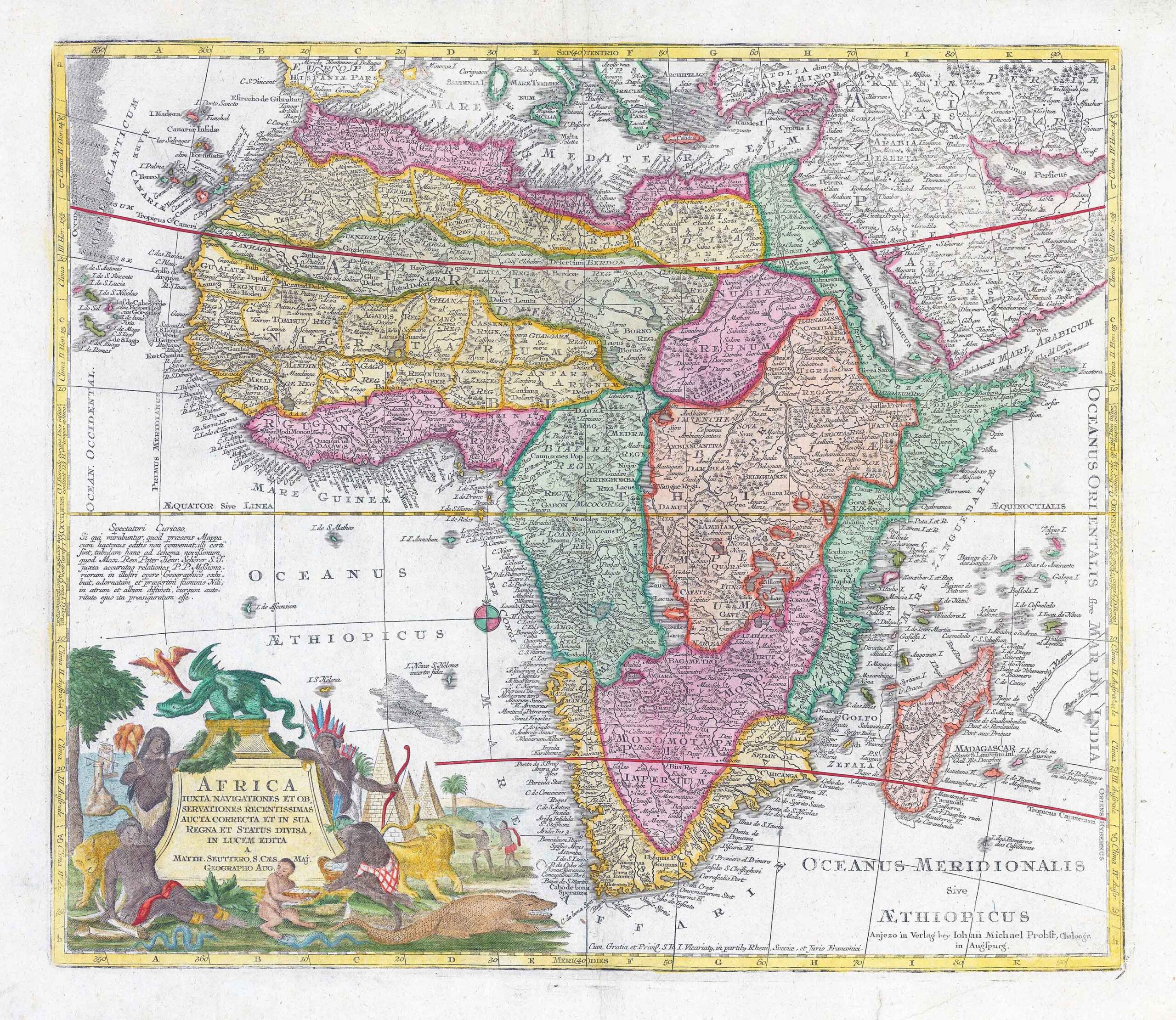
1730 - "Africa juxta navigationes et observationes recentissima aucta, correcta et in sua Regna et Status divisa in lucem edita". A highly decorative map of Africa by Matthäus Seutter. Large cartouche with monsters, aligators, natives, lighthouse, the east African coast islands and up to the coast of Arabia.
Matthäus Seutter (1678-1757) was a prominent German mapmaker in the mid-eighteenth century. Initially apprenticed to a brewer, he trained as an engraver under Johann Baptist Homann in Nuremburg before setting up shop in his native Augsburg. In 1727 he was granted the title Imperial Geographer. His most famous work is Atlas Novus Sive Tabulae Geographicae, published in two volumes ca. 1730, although the majority of his maps are based on earlier work by other cartographers like the Homanns, Delisles, and de Fer.
Overall size approximately 63cm x 55cm including margins.
Condition is very fine with central fold as issued and later hand colour.
£495.00