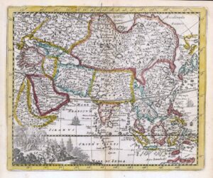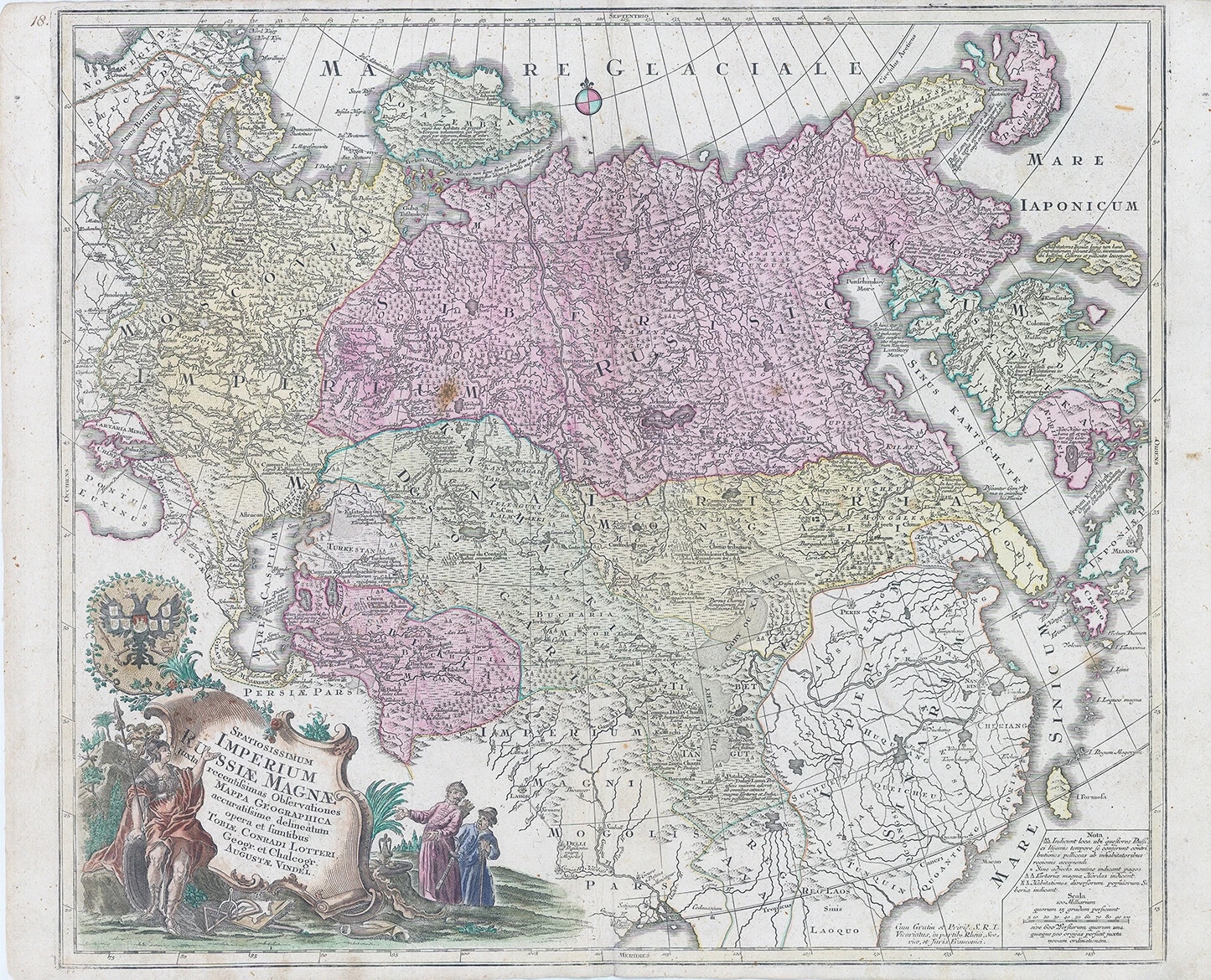
1760 - "Spatiosissimum Imperium Russiae Magnae juxta recentissimas Observationes Mappa Geographica".
Detailed map of the entire Empire of Russia, extending to the Pacific Ocean by Tobias Lotter.
A superb and decorative map of greater Russia, extending from Livonia in the west to Kamchatka in the east. To the south it runs from Georgia (not shown as part of Russia) across the Caspian and Uzbekistan to include Tibet. Korea and part of Japan appear at right. It is filled with place names, and even includes nomadic tent encampments in Mongolia. The Kamchatka Peninsula is presented in a curious shape owing to the lack of geographic information about the region. The map is decorated with a cartouche attended by a classical Amazon warrior, two Chinese merchants, and topped with the double headed eagle of the Russian Empire.
Condition is excellent with central fold as issued.
Size approximately 63cm x 51cm.
Tobias Conrad Lotter (1717-1777) is one of the best-known German mapmakers of the eighteenth century. He engraved many of the maps published by Matthaus Seutter, to whose daughter Lotter was married. He took over Seutter’s business in 1756. Lotter’s son, M. A. Lotter, succeeded his father in the business.
£535.00