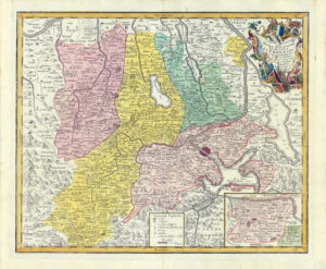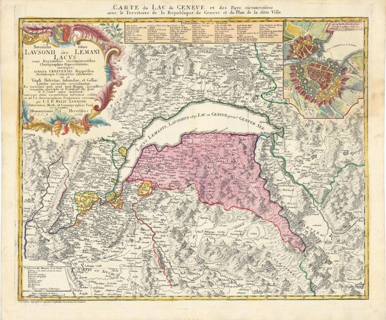

1762 - ' Novissima totius Lavsonii sive Lemani Lacus cum Regionibus circumjacentibus Chorograhicia Repraesentatito interquas interga Genevensis Republica…...... '
Rare map of the Lake Geneva region, with a large inset plan of the City of Geneva, based upon a larger map by Rizzi Zannoni. Includes an explanation of the Plan of Geneva locating 58 landmarks. The main map has remarkable topographical detail of the surrounding Alps & highly decorative cartouche.
Approximately 64cm x 53cm including margins with central fold as issued.
Combination of original hand colour and additional later colour (cartouche).
Blank on verso. Outstanding condition.
Johann Baptist Homann (1663-1724) was a mapmaker who founded the famous Homann Heirs publishing company. He lived his entire life in Bavaria, particularly in Nuremberg. Initially, Johann trained to become a priest before converting to Protestantism and working as a notary.
In 1702, Johann founded a publishing house that specialized in engravings. The firm flourished, becoming the leading map publisher in Germany and an important entity in the European map market. In 1715, Johann was named Imperial Geographer to the Holy Roman Empire by Charles VI and made a member of the Prussian Academy of Sciences. Most importantly for his business, his reputation and contacts gained him imperial printing privileges which protected his publications and recommended him to customers. Johann is best known for this Grosser Atlas ueber die ganze Welt, or the Grand Atlas of the World, published in 1716. After Johann died in 1724, the business passed to his son, Christoph (1703-1730). Upon Christoph’s early death, the company passed to subsequent heirs, with the name of the company changing to Homann Erben, or Homann Heirs. The firm continued in business until 1848.
Giovanni Antonio Bartolomeo Rizzi Zannoni (1736-1814) - Geographer and cartographer. B. in Padua, where studied under Giovanni Poleni. In 1753 was commissioned to do a map of Poland by Augustus III. Later travelled to Denmark, Sweden and Prussia; taken prisoner by the French during the battle of Rossbach (1757), he was brought to Paris where he remained for over 20 years and collaborated to the 'Atlas Moderne'. In 1781 he travelled to Naples where he had been commissioned to revise the charter of 1769. The result is 'L' Atlante Geografico del Regno di Napoli ' over 32 sheets, completed in 1812.
£535.00