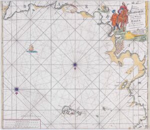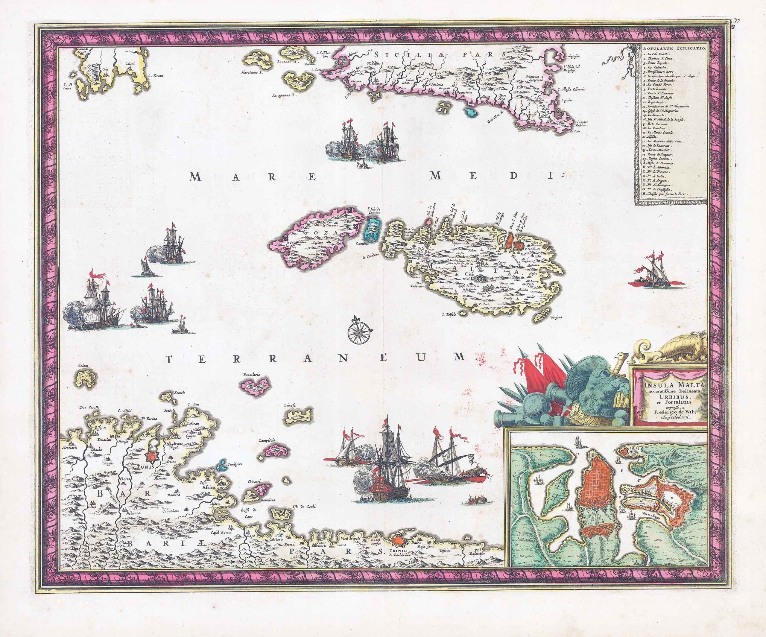
c1689 - "INSULA MALTA accuratissime delineata URBIBUS et Fortalitiis.....".
Decorative map of the islands Malta and Gozo, extending from the north African coast with Tunis to the coast of southern Sicily. Inset with a plan of Valetta to the lower right with a title cartouche above embellished with arms; numbered key to points of interest in upper right corner; ships throughout the Mediterranean. One of the most attractive maps of the island in the seventeenth century, the map is considerably enhanced by the framed effect of the border.
Frederick de Wit (1629 - 1706) was one of Holland's finest map engravers and publishers. His work encompassed the complete range of cartographic production; sea charts, world atlases, wall maps and Dutch and European town books containing plans and views. This map was published in his popular Atlas Maior.
Condition is generally fine with central fold as issued.
Size approximately 59cm x 49.5cm including margins.
Some original colour with later additions. No tears or repairs.
£1,400.00