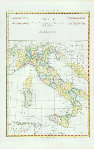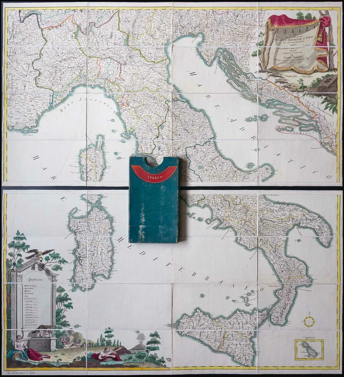
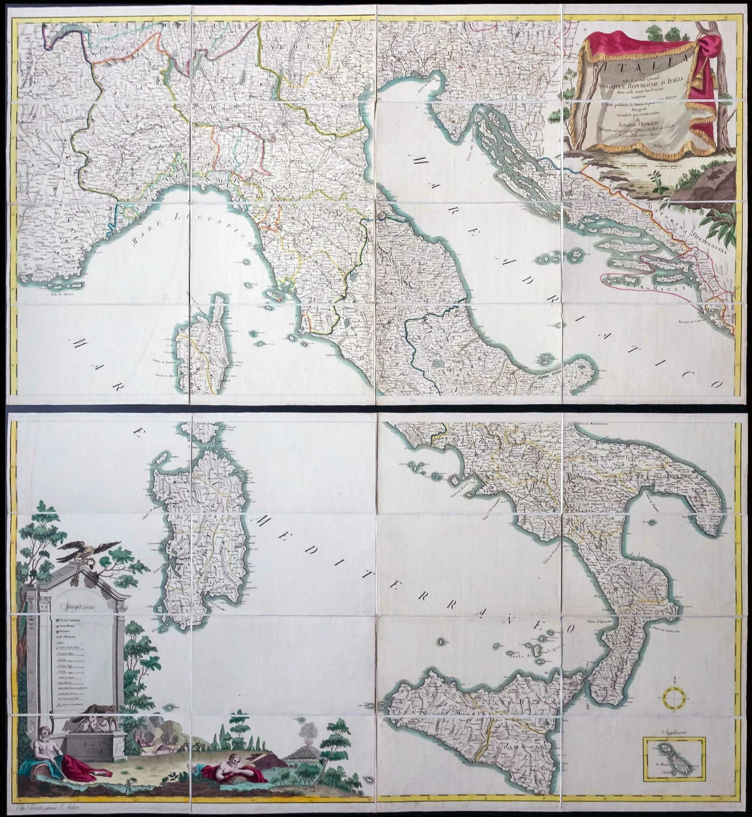
1799 - " ITALIA Cive tutte le grandi e piccole SOVRANITA E REPUBLICHE D'ITALIA divisi nelli nuovi loro Confini comprese le Strade pubbliche le Stazioni di posta eloro distanze.......da Ignazio Heymann... "
An outstanding pair of Folding maps of Italy including Corsica, Sardinia, Sicily, Istria and the Dalmatian coast. Drawn, engraved and published by Ignazio Heymann. Decorative cartouche at the top right and bottom left and a small map of Malta in the bottom right.
The borders between kingdoms, duchies and states and shown by outline colour.
Combined size of both maps is approximately 103cm x 114cm, and with original slip case.
£1,000.00