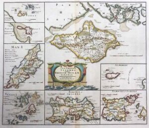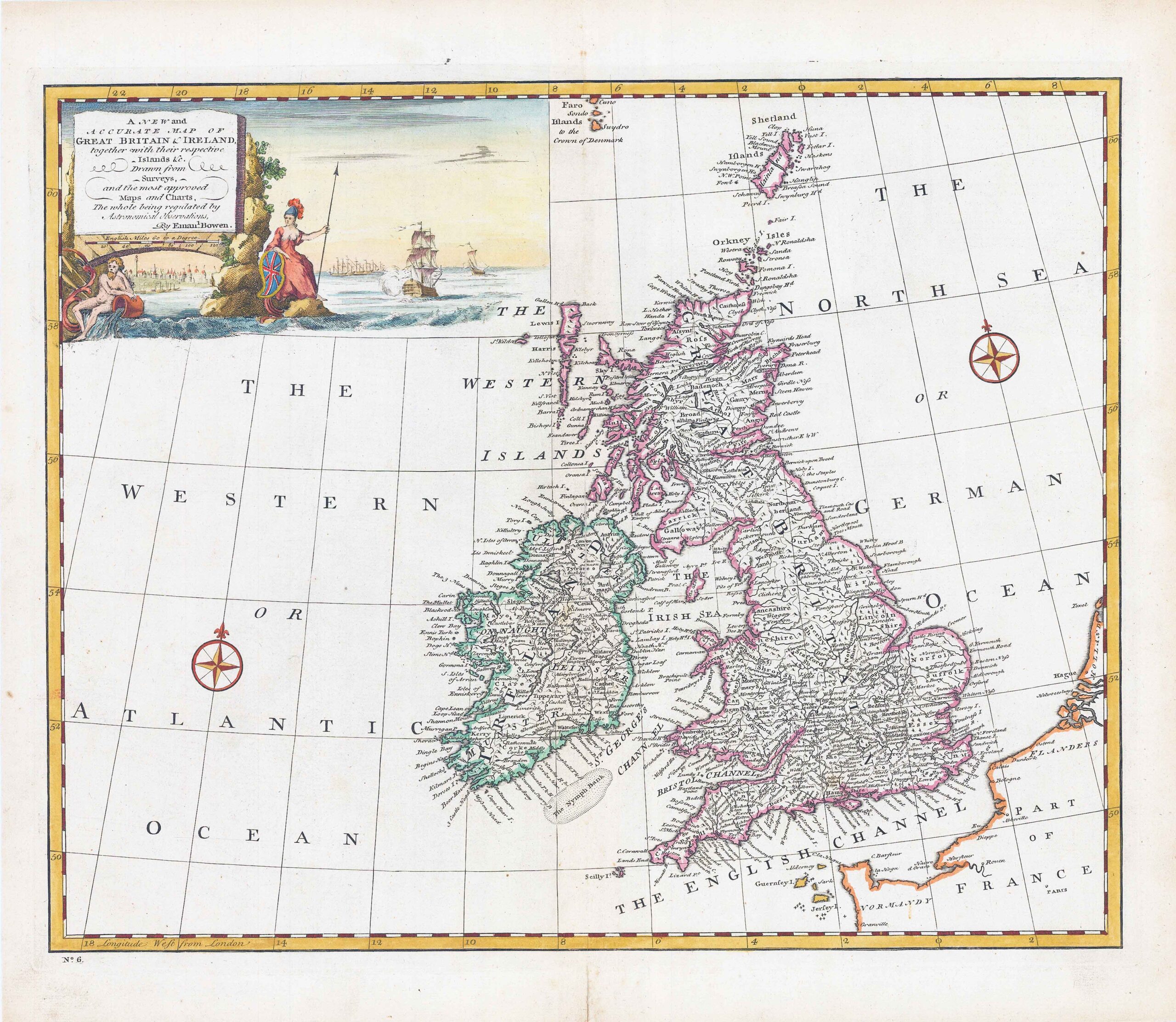
1744 "A New and Accurate Map of Great Britain & Ireland, together with their respective Islands &c. Drawn from surveys and the most approved Maps & Charts"
A very fine full hand coloured example of this map by Emmanuel Bowen with elaborate allegorical naval cartouche and 2 compass roses.
Emanuel Bowen (1694-1767) was a British engraver and print seller. He was most well-known for his atlases and county maps. Although he died in poverty, he was widely acknowledged for his expertise and was appointed as mapmaker to both George II of England and Louis XV of France. His business was carried on by his son, Thomas Bowen. He also trained many apprentices, two of whom became prominent mapmakers, Thomas Kitchin and Thomas Jeffreys.
Size approximately 45.5cm x 40cm including margins.
Central fold as issued and in excellent condition.
£220.00