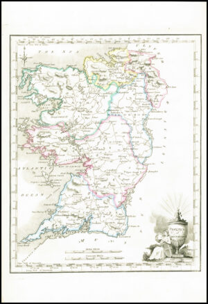
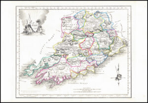
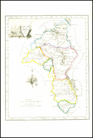
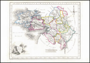
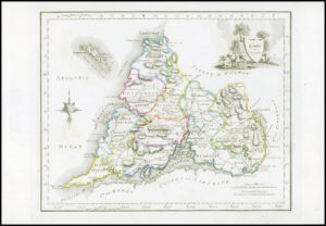
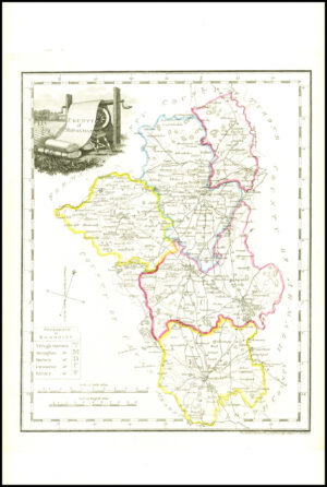
1776 - A fine original antique map by Bernard Scale titled: " COUNTY OF WEST MEATH "
A fine and rare engraved map taken from " AN HIBERNIAN ATLAS or GENERAL DESCRIPTION OF THE KINGDOM OF IRELAND Divided into Provinces with its sub-divisions of Counties, Baronies etc... " and published in London by Robert Sayer and John Bennet. With original wash colour and outline to the map area. This map also comes with its Title descriptive page and text.
Surveyor and cartographer, Peter Bernard Scale (1738 - 1826) was a son of Peter Scale, a Huguenot resident in England. He was a pupil of John Rocque and came to Dublin to assist Rocque in the surveys for his map of Dublin. He then went to Ireland about the age of sixteen and by the autumn of 1758 had married Rocque's sister and established himself as a Surveyor and Cartographer.
Overall size including margins 18cm x 23cm.
Perfect for mounting and framing.
Condition is excellent with very light offsetting.
£65.00