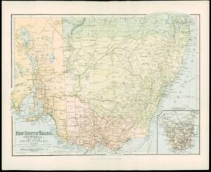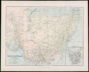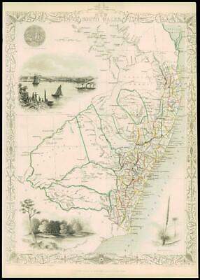
1851 - "NEW SOUTH WALES"
Drawn & engraved by John Rapkin for "The Illustrated Atlas and Modern History of the World" by Martin Montgomery.
An attractive and decorative map of NEW SOUTH WALES with vignette engravings of SYDNEY COVE, XANTHORRHEA, THE MURRAY.
Original outline hand colouring. Generally fine condition & unfolded (from the rare 1st Issue). Approx 360mm x 280mm and printed on heavy grade paper. Perfect for mounting and framing.
John Tallis (1817-1876) is considered to be one of the most renowned cartographers and publishers of the 19th Century. His maps are the last of the lavishly decorated & ornamental examples and as such considered works of art as well as geography.
He was born in Stourbridge in Worcestershire in 1817 and it is possible he stayed working in the Midlands working as a publisher in Birmingham, until he moved to London in the early 1840s. Tallis then set up the first of his publishing businesses in Cripplegate, with Frederick Tallis (his brother?). The business lasted from 1842 to 1849 when it was dissolved. By 1846, the business had moved to Smithfield. From 1850-1854, John Tallis set up another business, operating as 'John Tallis and Company' and it was during this period that he produced the Illustrated World Atlas, made for the 1851 Great Exhibition.
Tallis made the acquaintance of an engraved called John Rapkin who was an inspiration to Tallis. His stunning illustrations turned the rather dull maps in to illumanative and informative works of art.
£75.00