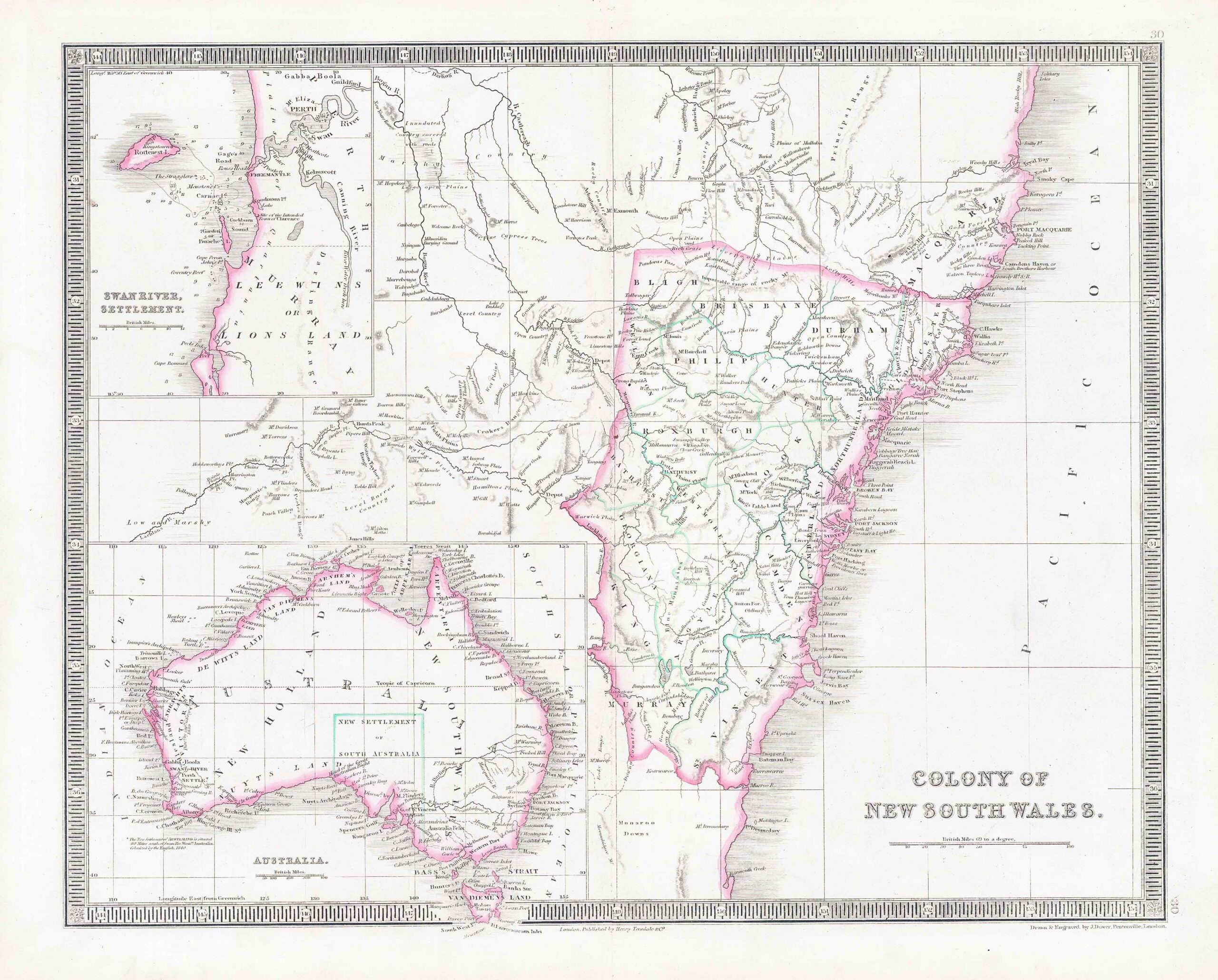
1850 - Original antique map titled "COLONY OF NEW SOUTH WALES" published by Henry Teesdale.
Published for "A NEW GENERAL ATLAS OF THE WORLD Compiled and Constructed with the Greatest Care from the Documents in the Foreign, Colonial, and Admiralty Offices, also those of the Honourable the East India Company".
Condition is very good with central fold, as issued and with original outline hand colouring. Overall size approximately 45.4cm x 38cm including margins.
£126.50