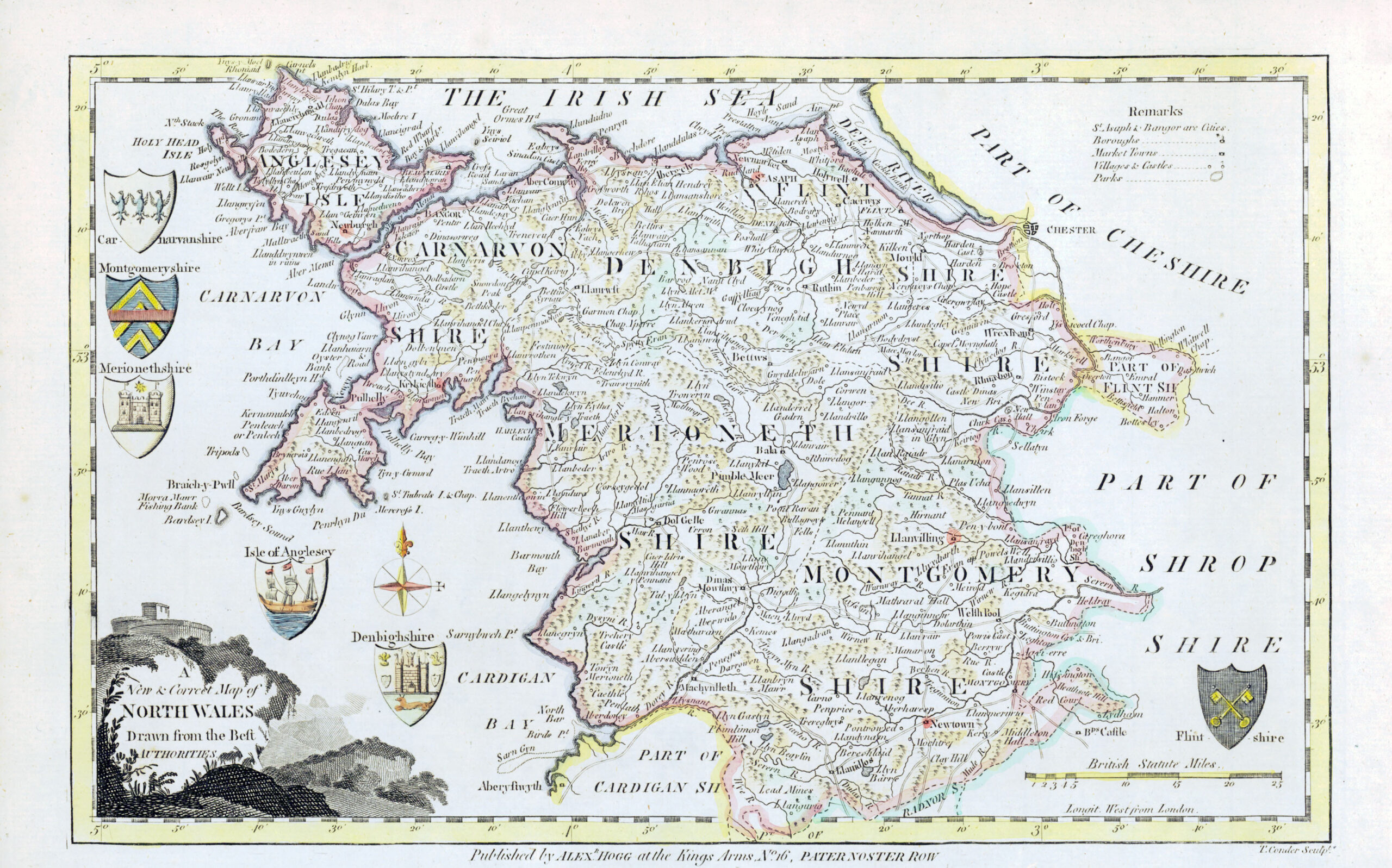
1769 "A New & Correct map of NORTH WALES Drawn from the Best Authorities". A fine original antique map published by Alex Hogg, Paternoster Road & engraved by T Conder. The maps is detailed with towns, roads and topography and feature decorative title cartouches. From George Augustus Walpoole's 'New and Complete British Traveller'.
Thomas Conder (c.1750-1831) was a British engraver, cartographer, bookseller, and printseller. An apprentice of Thomas Kitchin, he was involved in the production of maps for numerous different atlases and publications. He was succeeded in his bookselling business by his son, the writer Josiah Condor.
Overall size approximately 34.5cm x 22.5cm.
Condition is excellent with fine hand colouring.
£66.00