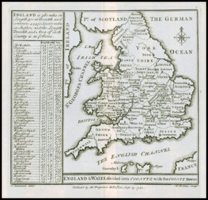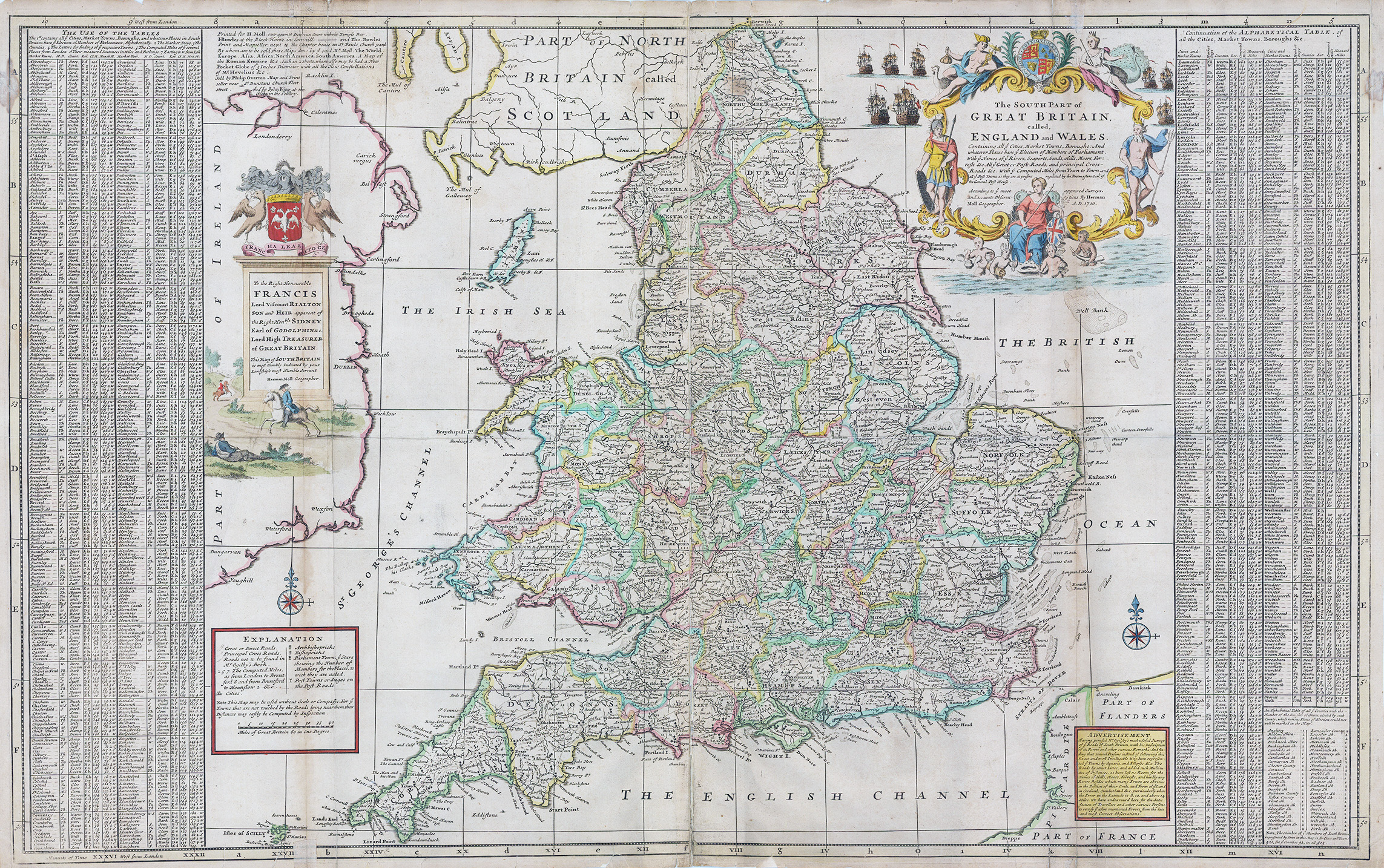
c1710 "SOUTH PART OF GREAT BRITAIN CALLED ENGLAND AND WALES Containing all ye Cities, Market towns, Boroughs........"
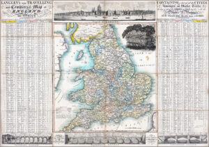
This wonderful large scale map of England and Wales was produced by the German émigré to London; Herman Moll. The map features a wealth of interesting fact and information, including two comprehensive and informative tables on the eastern and the western sides. The tables list in alphabetical order all the cities, towns and boroughs, what county they lie in, their relative sizes etc. Another boxed explanation tells you which towns and cities have an archbishoprick, a bishoprick, the number of members it sends to parliament, mileage distances and post towns etc. Two large and decorative cartouches, help to 'balance' the map; one is the largely allegorical title cartouche, and the other is the dedication cartouche. "The South Part of Great Britain" refers to the constitutional union of England and Scotland that occurred in 1707, which joined the north and south as it were. The map is full of interesting details including roads and distances between towns, which was a relatively new innovation in maps.
Overall size approximately 100cm x 63cm including margins.
Condition is generally OK. The centre fold has some surface splits and around the outer margins, there have been some paper splits with some historical repairs.
£485.00