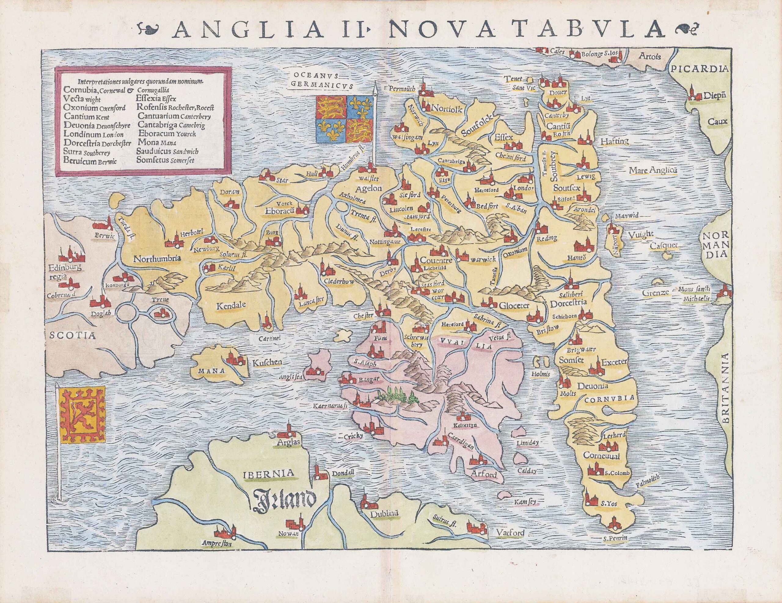
1542 - "ANGLIA II NOVA TABULA"
Original antique Woodcut published for "Geographia Universalis" by Sebastian Munster, key with prominent place names, & two 'standards' of England and Scotland decorate the map.
Munster's map was the first separately printed map of England and a landmark in the cartographic history of British maps. The map is oriented with East at the top and extends to Edinburgh in the North, also showing the East Coast of Ireland. A key in the upper left corner shows the English and Latin names for 17 major place names in England. The map includes the Royal Standard at the top centre and the Scottish flag at lower left. The map is unchanged from the 1540 edition.
Excellent condition with central fold as issued. Several light tape marks to the outer borders (from when previously mounted).
Size approximately 39cm x 30.5cm including margins.
Munster's Geographia (first published in 1540) and his later Cosmographia were cartographic landmarks. The Geographia included not only Ptolemaic maps, but also a number of landmark modern maps, including the first separate maps of the 4 continents, the first map of England and the earliest obtainable map of Scandinavia. The Cosmographia (first published in 1544) was the earliest German description of the world and a major work in the revival of geographic thought in 16th-century Europe. Altogether, about 40 editions of the Cosmographia appeared between 1544 and 1628. Munster dominated cartographic publication during the mid-16th Century. Munster is generally regarded as one of the most important map makers of the 16th Century. Munster was a linguist and mathematician, who initially taught Hebrew in Heidelberg. He issued his first mapping of Germany in 1529, after which he issued a call geographical information about Germany to scholars throughout the country. The response was better than hoped for, and included substantial foreign material, which supplied him with up to date, if not necessarily accurate maps for the issuance of his Geographia in 1540.
£1,000.00